You are here: Home > Network List > US - United States National Seismic Network Stations List
> Station LAO LASA Array, Montana, USA > Earthquake Result Viewer
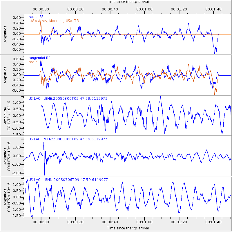
LAO LASA Array, Montana, USA - Earthquake Result Viewer
*The percent match for this event was below the threshold and hence no stack was calculated.
| Earthquake location: |
Kamchatka Peninsula, Russia |
| Earthquake latitude/longitude: |
51.5/156.5 |
| Earthquake time(UTC): |
2008/03/06 (066) 09:38:43 GMT |
| Earthquake Depth: |
134 km |
| Earthquake Magnitude: |
5.6 MB, 5.5 MW, 5.5 MW |
| Earthquake Catalog/Contributor: |
WHDF/NEIC |
|
| Network: |
US United States National Seismic Network |
| Station: |
LAO LASA Array, Montana, USA |
| Lat/Lon: |
46.69 N/106.22 W |
| Elevation: |
902 m |
|
| Distance: |
59.2 deg |
| Az: |
52.67 deg |
| Baz: |
313.808 deg |
| Ray Param: |
$rayparam |
*The percent match for this event was below the threshold and hence was not used in the summary stack. |
|
| Radial Match: |
50.889587 % |
| Radial Bump: |
389 |
| Transverse Match: |
68.87528 % |
| Transverse Bump: |
400 |
| SOD ConfigId: |
2504 |
| Insert Time: |
2010-03-05 07:13:39.270 +0000 |
| GWidth: |
2.5 |
| Max Bumps: |
400 |
| Tol: |
0.001 |
|
Signal To Noise
| Channel | StoN | STA | LTA |
| US:LAO: :BHZ:20080306T09:47:59.611997Z | 3.0904005 | 7.384602E-7 | 2.389529E-7 |
| US:LAO: :BHN:20080306T09:47:59.611997Z | 0.9051499 | 6.765305E-7 | 7.474237E-7 |
| US:LAO: :BHE:20080306T09:47:59.611997Z | 0.69271606 | 3.9804706E-7 | 5.7461796E-7 |
| Arrivals |
| Ps | |
| PpPs | |
| PsPs/PpSs | |


