You are here: Home > Network List > TA - USArray Transportable Network (new EarthScope stations) Stations List
> Station 121A Cookes Peak, Deming, NM, USA > Earthquake Result Viewer
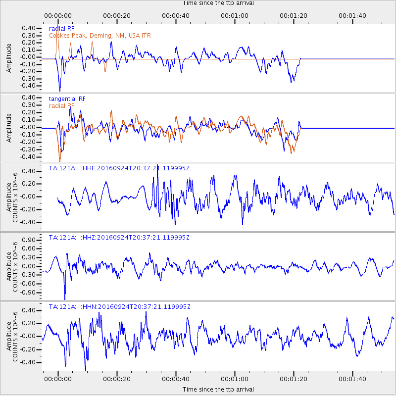
121A Cookes Peak, Deming, NM, USA - Earthquake Result Viewer
*The percent match for this event was below the threshold and hence no stack was calculated.
| Earthquake location: |
Chile-Bolivia Border Region |
| Earthquake latitude/longitude: |
-21.5/-68.4 |
| Earthquake time(UTC): |
2016/09/24 (268) 20:27:18 GMT |
| Earthquake Depth: |
104 km |
| Earthquake Magnitude: |
5.1 Mww |
| Earthquake Catalog/Contributor: |
NEIC PDE/us |
|
| Network: |
TA USArray Transportable Network (new EarthScope stations) |
| Station: |
121A Cookes Peak, Deming, NM, USA |
| Lat/Lon: |
32.53 N/107.79 W |
| Elevation: |
1652 m |
|
| Distance: |
65.7 deg |
| Az: |
323.924 deg |
| Baz: |
139.533 deg |
| Ray Param: |
$rayparam |
*The percent match for this event was below the threshold and hence was not used in the summary stack. |
|
| Radial Match: |
62.30628 % |
| Radial Bump: |
400 |
| Transverse Match: |
71.4437 % |
| Transverse Bump: |
400 |
| SOD ConfigId: |
11737051 |
| Insert Time: |
2019-04-25 14:59:59.798 +0000 |
| GWidth: |
2.5 |
| Max Bumps: |
400 |
| Tol: |
0.001 |
|
Signal To Noise
| Channel | StoN | STA | LTA |
| TA:121A: :HHZ:20160924T20:37:21.119995Z | 3.114048 | 3.5953732E-7 | 1.1545658E-7 |
| TA:121A: :HHN:20160924T20:37:21.119995Z | 1.495494 | 1.6135934E-7 | 1.0789702E-7 |
| TA:121A: :HHE:20160924T20:37:21.119995Z | 1.7638576 | 1.8864179E-7 | 1.0694842E-7 |
| Arrivals |
| Ps | |
| PpPs | |
| PsPs/PpSs | |


