You are here: Home > Network List > US - United States National Seismic Network Stations List
> Station DGMT Dagmar, Montana, USA > Earthquake Result Viewer
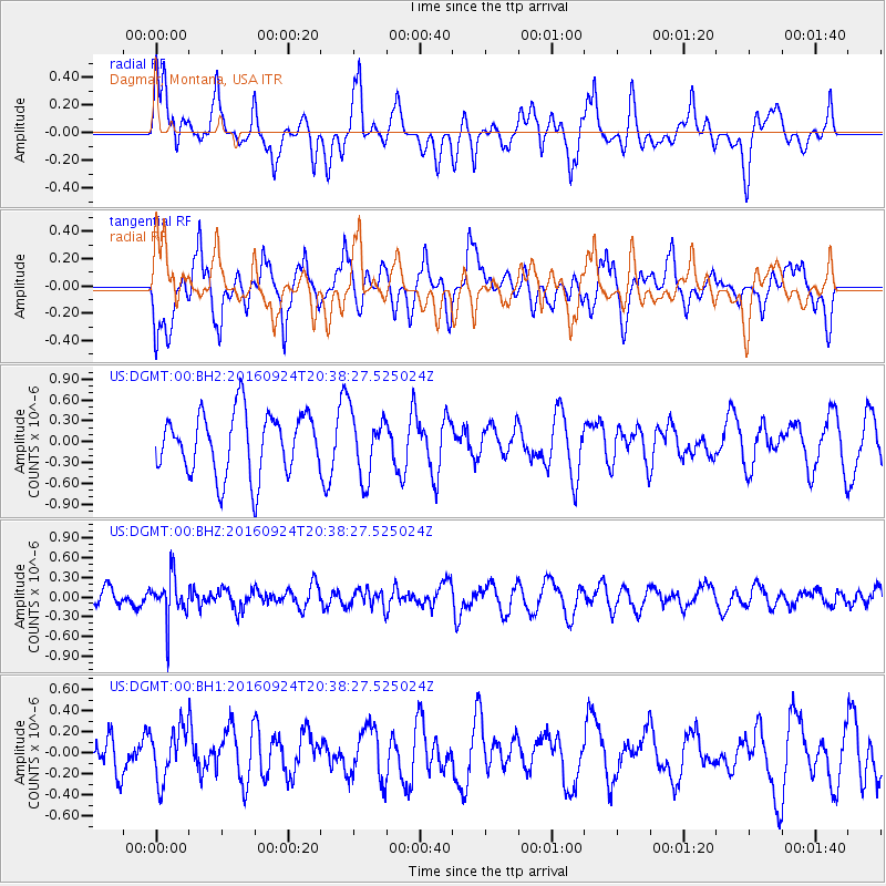
DGMT Dagmar, Montana, USA - Earthquake Result Viewer
*The percent match for this event was below the threshold and hence no stack was calculated.
| Earthquake location: |
Chile-Bolivia Border Region |
| Earthquake latitude/longitude: |
-21.5/-68.4 |
| Earthquake time(UTC): |
2016/09/24 (268) 20:27:18 GMT |
| Earthquake Depth: |
104 km |
| Earthquake Magnitude: |
5.1 Mww |
| Earthquake Catalog/Contributor: |
NEIC PDE/us |
|
| Network: |
US United States National Seismic Network |
| Station: |
DGMT Dagmar, Montana, USA |
| Lat/Lon: |
48.47 N/104.20 W |
| Elevation: |
0.0 m |
|
| Distance: |
76.7 deg |
| Az: |
336.397 deg |
| Baz: |
145.934 deg |
| Ray Param: |
$rayparam |
*The percent match for this event was below the threshold and hence was not used in the summary stack. |
|
| Radial Match: |
52.680027 % |
| Radial Bump: |
400 |
| Transverse Match: |
54.083782 % |
| Transverse Bump: |
400 |
| SOD ConfigId: |
11737051 |
| Insert Time: |
2019-04-25 15:00:44.002 +0000 |
| GWidth: |
2.5 |
| Max Bumps: |
400 |
| Tol: |
0.001 |
|
Signal To Noise
| Channel | StoN | STA | LTA |
| US:DGMT:00:BHZ:20160924T20:38:27.525024Z | 2.6168334 | 3.2271845E-7 | 1.2332403E-7 |
| US:DGMT:00:BH1:20160924T20:38:27.525024Z | 1.0811319 | 2.4924228E-7 | 2.3053828E-7 |
| US:DGMT:00:BH2:20160924T20:38:27.525024Z | 1.0366765 | 4.5993372E-7 | 4.4366172E-7 |
| Arrivals |
| Ps | |
| PpPs | |
| PsPs/PpSs | |


