You are here: Home > Network List > WY - Yellowstone Wyoming Seismic Network Stations List
> Station YHH Holmes Hill, YNP, WY, USA > Earthquake Result Viewer
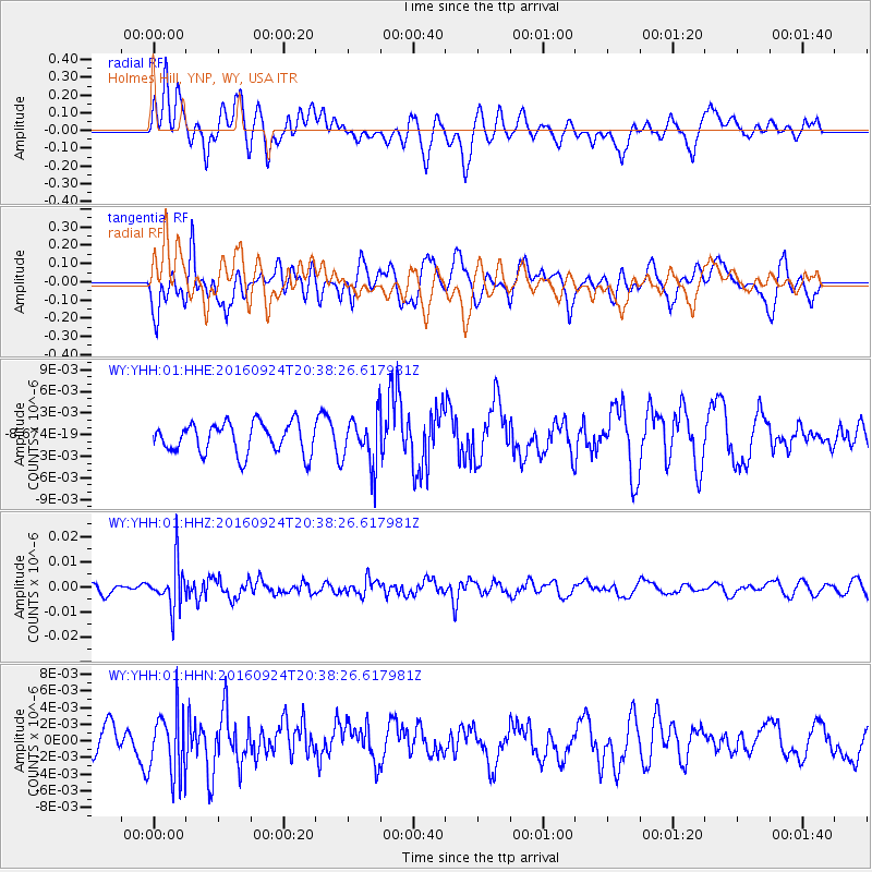
YHH Holmes Hill, YNP, WY, USA - Earthquake Result Viewer
*The percent match for this event was below the threshold and hence no stack was calculated.
| Earthquake location: |
Chile-Bolivia Border Region |
| Earthquake latitude/longitude: |
-21.5/-68.4 |
| Earthquake time(UTC): |
2016/09/24 (268) 20:27:18 GMT |
| Earthquake Depth: |
104 km |
| Earthquake Magnitude: |
5.1 Mww |
| Earthquake Catalog/Contributor: |
NEIC PDE/us |
|
| Network: |
WY Yellowstone Wyoming Seismic Network |
| Station: |
YHH Holmes Hill, YNP, WY, USA |
| Lat/Lon: |
44.79 N/110.85 W |
| Elevation: |
2717 m |
|
| Distance: |
76.6 deg |
| Az: |
330.357 deg |
| Baz: |
139.708 deg |
| Ray Param: |
$rayparam |
*The percent match for this event was below the threshold and hence was not used in the summary stack. |
|
| Radial Match: |
47.58516 % |
| Radial Bump: |
400 |
| Transverse Match: |
59.83767 % |
| Transverse Bump: |
400 |
| SOD ConfigId: |
11737051 |
| Insert Time: |
2019-04-25 15:01:48.213 +0000 |
| GWidth: |
2.5 |
| Max Bumps: |
400 |
| Tol: |
0.001 |
|
Signal To Noise
| Channel | StoN | STA | LTA |
| WY:YHH:01:HHZ:20160924T20:38:26.617981Z | 4.769318 | 9.068744E-9 | 1.901476E-9 |
| WY:YHH:01:HHN:20160924T20:38:26.617981Z | 1.7753644 | 3.892953E-9 | 2.192763E-9 |
| WY:YHH:01:HHE:20160924T20:38:26.617981Z | 1.5993869 | 3.3665744E-9 | 2.1049156E-9 |
| Arrivals |
| Ps | |
| PpPs | |
| PsPs/PpSs | |


