You are here: Home > Network List > AV - Alaska Volcano Observatory Stations List
> Station SPCR Ckakachatna River, Mount Spurr, Alaska > Earthquake Result Viewer
SPCR Ckakachatna River, Mount Spurr, Alaska - Earthquake Result Viewer
*The percent match for this event was below the threshold and hence no stack was calculated.
| Earthquake location: |
Tonga Islands |
| Earthquake latitude/longitude: |
-18.1/-175.0 |
| Earthquake time(UTC): |
2016/09/24 (268) 21:07:13 GMT |
| Earthquake Depth: |
179 km |
| Earthquake Magnitude: |
6.3 MO |
| Earthquake Catalog/Contributor: |
NEIC PDE/NEIC ALERT |
|
| Network: |
AV Alaska Volcano Observatory |
| Station: |
SPCR Ckakachatna River, Mount Spurr, Alaska |
| Lat/Lon: |
61.20 N/152.21 W |
| Elevation: |
984 m |
|
| Distance: |
81.1 deg |
| Az: |
10.946 deg |
| Baz: |
201.9 deg |
| Ray Param: |
$rayparam |
*The percent match for this event was below the threshold and hence was not used in the summary stack. |
|
| Radial Match: |
63.5255 % |
| Radial Bump: |
400 |
| Transverse Match: |
61.338905 % |
| Transverse Bump: |
400 |
| SOD ConfigId: |
11737051 |
| Insert Time: |
2019-04-25 15:06:16.113 +0000 |
| GWidth: |
2.5 |
| Max Bumps: |
400 |
| Tol: |
0.001 |
|
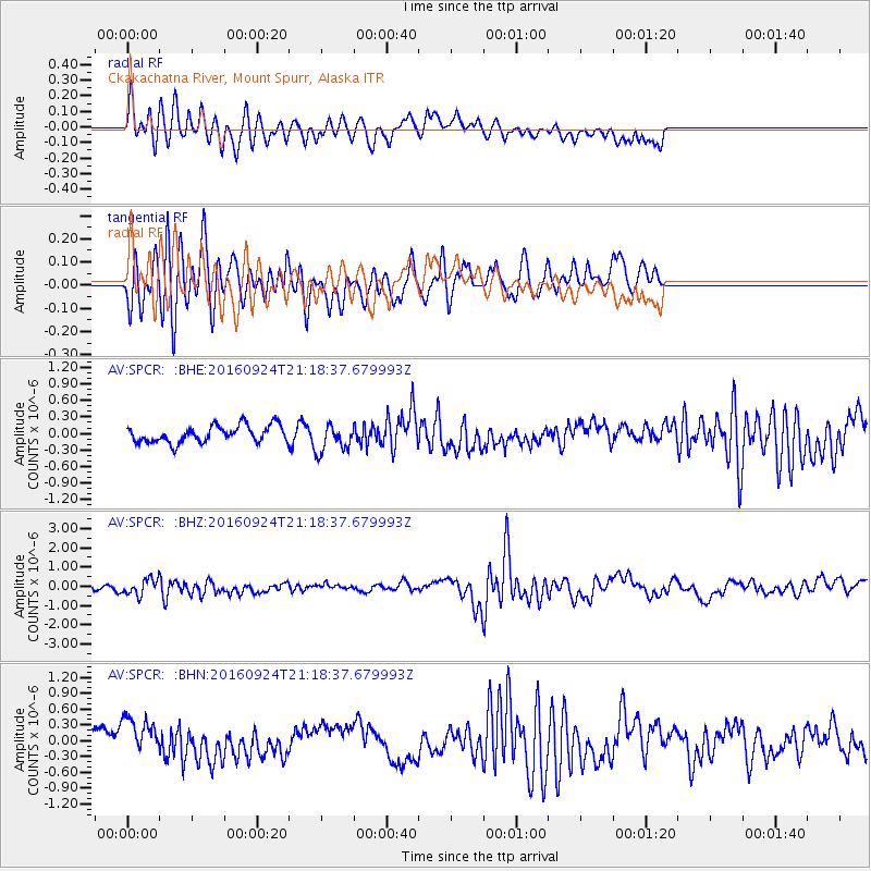
Signal To Noise
| Channel | StoN | STA | LTA |
| AV:SPCR: :BHZ:20160924T21:18:37.679993Z | 2.5915742 | 4.2431463E-7 | 1.6372854E-7 |
| AV:SPCR: :BHN:20160924T21:18:37.679993Z | 2.9168177 | 3.8325405E-7 | 1.3139459E-7 |
| AV:SPCR: :BHE:20160924T21:18:37.679993Z | 1.7033591 | 2.6017182E-7 | 1.5274043E-7 |
| Arrivals |
| Ps | |
| PpPs | |
| PsPs/PpSs | |


