You are here: Home > Network List > TA - USArray Transportable Network (new EarthScope stations) Stations List
> Station R32K Eaglecrest, AK, USA > Earthquake Result Viewer
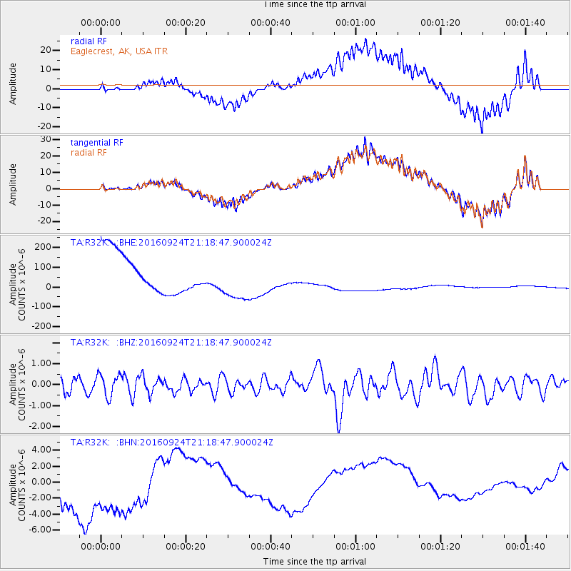
R32K Eaglecrest, AK, USA - Earthquake Result Viewer
*The percent match for this event was below the threshold and hence no stack was calculated.
| Earthquake location: |
Tonga Islands |
| Earthquake latitude/longitude: |
-18.1/-175.0 |
| Earthquake time(UTC): |
2016/09/24 (268) 21:07:13 GMT |
| Earthquake Depth: |
179 km |
| Earthquake Magnitude: |
6.3 MO |
| Earthquake Catalog/Contributor: |
NEIC PDE/NEIC ALERT |
|
| Network: |
TA USArray Transportable Network (new EarthScope stations) |
| Station: |
R32K Eaglecrest, AK, USA |
| Lat/Lon: |
58.27 N/134.52 W |
| Elevation: |
386 m |
|
| Distance: |
83.1 deg |
| Az: |
20.217 deg |
| Baz: |
218.467 deg |
| Ray Param: |
$rayparam |
*The percent match for this event was below the threshold and hence was not used in the summary stack. |
|
| Radial Match: |
53.03725 % |
| Radial Bump: |
399 |
| Transverse Match: |
53.23586 % |
| Transverse Bump: |
400 |
| SOD ConfigId: |
11737051 |
| Insert Time: |
2019-04-25 15:12:16.436 +0000 |
| GWidth: |
2.5 |
| Max Bumps: |
400 |
| Tol: |
0.001 |
|
Signal To Noise
| Channel | StoN | STA | LTA |
| TA:R32K: :BHZ:20160924T21:18:47.900024Z | 1.1496452 | 5.3232816E-7 | 4.6303688E-7 |
| TA:R32K: :BHN:20160924T21:18:47.900024Z | 0.82955426 | 9.382702E-6 | 1.1310534E-5 |
| TA:R32K: :BHE:20160924T21:18:47.900024Z | 1.1267097 | 1.096733E-4 | 9.733945E-5 |
| Arrivals |
| Ps | |
| PpPs | |
| PsPs/PpSs | |


