You are here: Home > Network List > TA - USArray Transportable Network (new EarthScope stations) Stations List
> Station I05D Terrebonne, OR, USA > Earthquake Result Viewer
I05D Terrebonne, OR, USA - Earthquake Result Viewer

| Earthquake location: |
Fiji Islands Region |
| Earthquake latitude/longitude: |
-19.8/-178.3 |
| Earthquake time(UTC): |
2016/09/24 (268) 21:28:42 GMT |
| Earthquake Depth: |
594 km |
| Earthquake Magnitude: |
6.8 MO |
| Earthquake Catalog/Contributor: |
NEIC PDE/NEIC ALERT |
|
| Network: |
TA USArray Transportable Network (new EarthScope stations) |
| Station: |
I05D Terrebonne, OR, USA |
| Lat/Lon: |
44.34 N/121.34 W |
| Elevation: |
1546 m |
|
| Distance: |
82.3 deg |
| Az: |
37.356 deg |
| Baz: |
232.752 deg |
| Ray Param: |
0.045179807 |
| Estimated Moho Depth: |
58.5 km |
| Estimated Crust Vp/Vs: |
2.01 |
| Assumed Crust Vp: |
6.597 km/s |
| Estimated Crust Vs: |
3.278 km/s |
| Estimated Crust Poisson's Ratio: |
0.34 |
|
| Radial Match: |
82.89765 % |
| Radial Bump: |
400 |
| Transverse Match: |
70.16119 % |
| Transverse Bump: |
400 |
| SOD ConfigId: |
11737051 |
| Insert Time: |
2019-04-25 15:23:41.981 +0000 |
| GWidth: |
2.5 |
| Max Bumps: |
400 |
| Tol: |
0.001 |
|
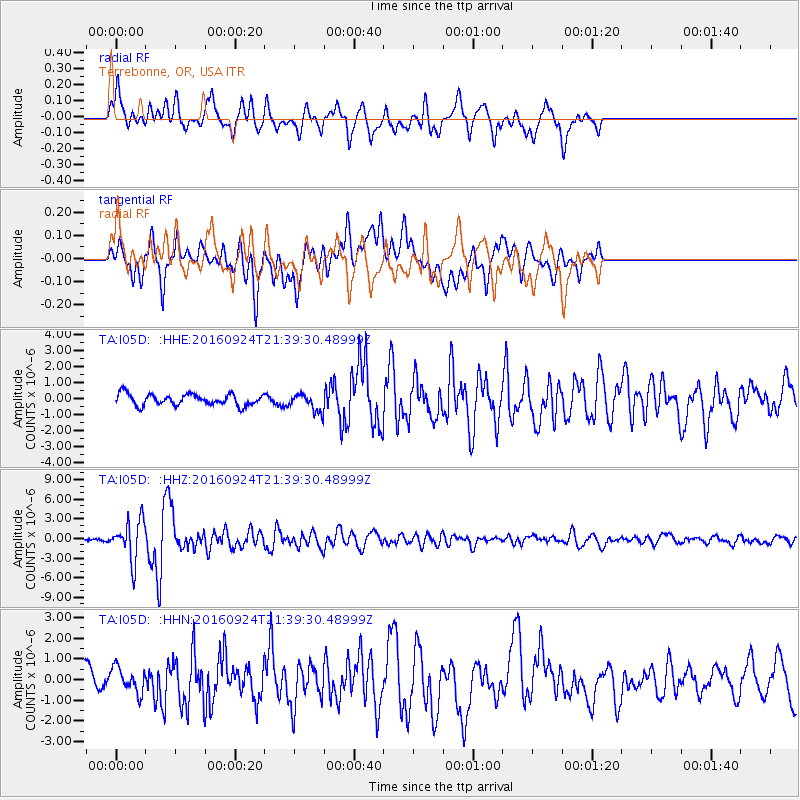
Signal To Noise
| Channel | StoN | STA | LTA |
| TA:I05D: :HHZ:20160924T21:39:30.48999Z | 14.014951 | 3.083181E-6 | 2.1999227E-7 |
| TA:I05D: :HHN:20160924T21:39:30.48999Z | 1.7271453 | 6.035156E-7 | 3.4942954E-7 |
| TA:I05D: :HHE:20160924T21:39:30.48999Z | 1.7432841 | 6.081953E-7 | 3.4887904E-7 |
| Arrivals |
| Ps | 9.2 SECOND |
| PpPs | 26 SECOND |
| PsPs/PpSs | 35 SECOND |


