You are here: Home > Network List > TA - USArray Transportable Network (new EarthScope stations) Stations List
> Station R32K Eaglecrest, AK, USA > Earthquake Result Viewer
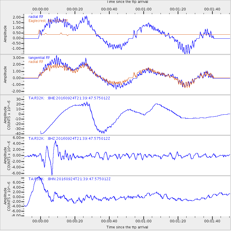
R32K Eaglecrest, AK, USA - Earthquake Result Viewer
*The percent match for this event was below the threshold and hence no stack was calculated.
| Earthquake location: |
Fiji Islands Region |
| Earthquake latitude/longitude: |
-19.8/-178.3 |
| Earthquake time(UTC): |
2016/09/24 (268) 21:28:42 GMT |
| Earthquake Depth: |
594 km |
| Earthquake Magnitude: |
6.8 MO |
| Earthquake Catalog/Contributor: |
NEIC PDE/NEIC ALERT |
|
| Network: |
TA USArray Transportable Network (new EarthScope stations) |
| Station: |
R32K Eaglecrest, AK, USA |
| Lat/Lon: |
58.27 N/134.52 W |
| Elevation: |
386 m |
|
| Distance: |
85.8 deg |
| Az: |
21.493 deg |
| Baz: |
220.748 deg |
| Ray Param: |
$rayparam |
*The percent match for this event was below the threshold and hence was not used in the summary stack. |
|
| Radial Match: |
23.936573 % |
| Radial Bump: |
400 |
| Transverse Match: |
21.412127 % |
| Transverse Bump: |
400 |
| SOD ConfigId: |
11737051 |
| Insert Time: |
2019-04-25 15:24:41.218 +0000 |
| GWidth: |
2.5 |
| Max Bumps: |
400 |
| Tol: |
0.001 |
|
Signal To Noise
| Channel | StoN | STA | LTA |
| TA:R32K: :BHZ:20160924T21:39:47.575012Z | 4.4827085 | 1.8471746E-6 | 4.1206667E-7 |
| TA:R32K: :BHN:20160924T21:39:47.575012Z | 4.174082 | 6.963396E-6 | 1.6682461E-6 |
| TA:R32K: :BHE:20160924T21:39:47.575012Z | 1.2605642 | 2.4909987E-5 | 1.9760982E-5 |
| Arrivals |
| Ps | |
| PpPs | |
| PsPs/PpSs | |


