You are here: Home > Network List > US - United States National Seismic Network Stations List
> Station ELK Elko, Nevada, USA > Earthquake Result Viewer
ELK Elko, Nevada, USA - Earthquake Result Viewer

| Earthquake location: |
North Atlantic Ocean |
| Earthquake latitude/longitude: |
18.3/-58.6 |
| Earthquake time(UTC): |
2003/05/14 (134) 06:03:35 GMT |
| Earthquake Depth: |
42 km |
| Earthquake Magnitude: |
6.5 MB, 6.5 MS, 6.6 MW, 6.6 MW |
| Earthquake Catalog/Contributor: |
WHDF/NEIC |
|
| Network: |
US United States National Seismic Network |
| Station: |
ELK Elko, Nevada, USA |
| Lat/Lon: |
40.74 N/115.24 W |
| Elevation: |
2210 m |
|
| Distance: |
53.1 deg |
| Az: |
307.545 deg |
| Baz: |
97.422 deg |
| Ray Param: |
0.06620908 |
| Estimated Moho Depth: |
32.0 km |
| Estimated Crust Vp/Vs: |
1.67 |
| Assumed Crust Vp: |
6.276 km/s |
| Estimated Crust Vs: |
3.752 km/s |
| Estimated Crust Poisson's Ratio: |
0.22 |
|
| Radial Match: |
95.01091 % |
| Radial Bump: |
343 |
| Transverse Match: |
89.77053 % |
| Transverse Bump: |
400 |
| SOD ConfigId: |
110177 |
| Insert Time: |
2010-03-05 07:19:56.648 +0000 |
| GWidth: |
2.5 |
| Max Bumps: |
400 |
| Tol: |
0.001 |
|
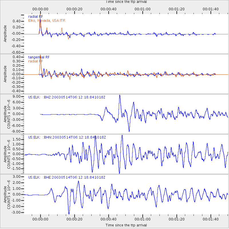
Signal To Noise
| Channel | StoN | STA | LTA |
| US:ELK: :BHN:20030514T06:12:18.841018Z | 0.9935835 | 3.4917445E-8 | 3.514294E-8 |
| US:ELK: :BHE:20030514T06:12:18.841018Z | 1.9974842 | 6.3167995E-8 | 3.1623777E-8 |
| US:ELK: :BHZ:20030514T06:12:18.841018Z | 5.312007 | 2.1994077E-7 | 4.140446E-8 |
| Arrivals |
| Ps | 3.6 SECOND |
| PpPs | 13 SECOND |
| PsPs/PpSs | 17 SECOND |


