You are here: Home > Network List > US - United States National Seismic Network Stations List
> Station ELK Elko, Nevada, USA > Earthquake Result Viewer
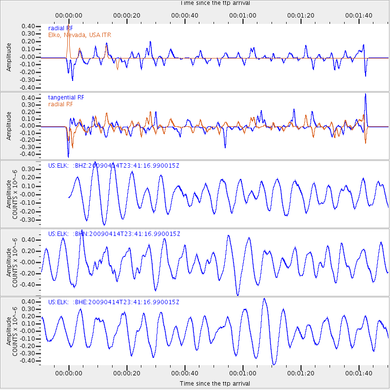
ELK Elko, Nevada, USA - Earthquake Result Viewer
*The percent match for this event was below the threshold and hence no stack was calculated.
| Earthquake location: |
Fiji Islands Region |
| Earthquake latitude/longitude: |
-16.3/-177.7 |
| Earthquake time(UTC): |
2009/04/14 (104) 23:29:33 GMT |
| Earthquake Depth: |
10 km |
| Earthquake Magnitude: |
5.5 MS, 5.4 MB, 5.9 MW, 5.9 MW |
| Earthquake Catalog/Contributor: |
WHDF/NEIC |
|
| Network: |
US United States National Seismic Network |
| Station: |
ELK Elko, Nevada, USA |
| Lat/Lon: |
40.74 N/115.24 W |
| Elevation: |
2210 m |
|
| Distance: |
81.1 deg |
| Az: |
43.016 deg |
| Baz: |
239.566 deg |
| Ray Param: |
$rayparam |
*The percent match for this event was below the threshold and hence was not used in the summary stack. |
|
| Radial Match: |
54.11476 % |
| Radial Bump: |
400 |
| Transverse Match: |
71.343 % |
| Transverse Bump: |
400 |
| SOD ConfigId: |
2658 |
| Insert Time: |
2010-03-05 07:20:19.093 +0000 |
| GWidth: |
2.5 |
| Max Bumps: |
400 |
| Tol: |
0.001 |
|
Signal To Noise
| Channel | StoN | STA | LTA |
| US:ELK: :BHN:20090414T23:41:16.990015Z | 3.1250901 | 3.444471E-7 | 1.10219894E-7 |
| US:ELK: :BHE:20090414T23:41:16.990015Z | 1.211587 | 1.9704004E-7 | 1.6262972E-7 |
| US:ELK: :BHZ:20090414T23:41:16.990015Z | 0.82544315 | 1.7395683E-7 | 2.1074356E-7 |
| Arrivals |
| Ps | |
| PpPs | |
| PsPs/PpSs | |


