You are here: Home > Network List > US - United States National Seismic Network Stations List
> Station ELK Elko, Nevada, USA > Earthquake Result Viewer
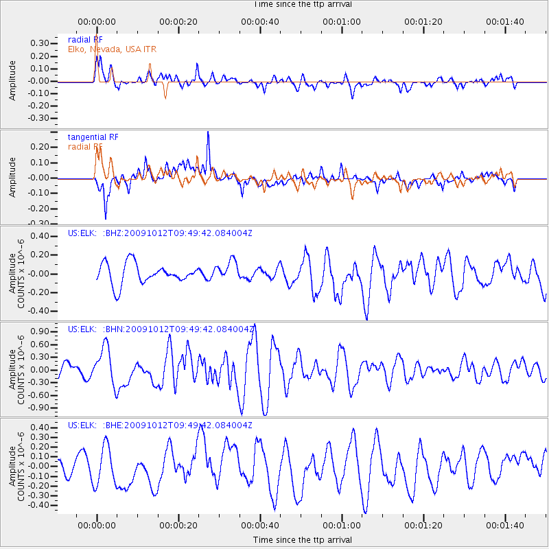
ELK Elko, Nevada, USA - Earthquake Result Viewer
*The percent match for this event was below the threshold and hence no stack was calculated.
| Earthquake location: |
Santa Cruz Islands |
| Earthquake latitude/longitude: |
-12.4/166.5 |
| Earthquake time(UTC): |
2009/10/12 (285) 09:37:21 GMT |
| Earthquake Depth: |
42 km |
| Earthquake Magnitude: |
5.9 MB, 5.9 MS, 6.2 MW, 6.2 MW |
| Earthquake Catalog/Contributor: |
WHDF/NEIC |
|
| Network: |
US United States National Seismic Network |
| Station: |
ELK Elko, Nevada, USA |
| Lat/Lon: |
40.74 N/115.24 W |
| Elevation: |
2210 m |
|
| Distance: |
89.3 deg |
| Az: |
48.069 deg |
| Baz: |
253.051 deg |
| Ray Param: |
$rayparam |
*The percent match for this event was below the threshold and hence was not used in the summary stack. |
|
| Radial Match: |
57.779137 % |
| Radial Bump: |
400 |
| Transverse Match: |
67.01518 % |
| Transverse Bump: |
400 |
| SOD ConfigId: |
2622 |
| Insert Time: |
2010-03-05 07:20:56.488 +0000 |
| GWidth: |
2.5 |
| Max Bumps: |
400 |
| Tol: |
0.001 |
|
Signal To Noise
| Channel | StoN | STA | LTA |
| US:ELK: :BHN:20091012T09:49:42.084004Z | 3.10703 | 4.5290977E-7 | 1.4576936E-7 |
| US:ELK: :BHE:20091012T09:49:42.084004Z | 1.607223 | 1.9988039E-7 | 1.2436381E-7 |
| US:ELK: :BHZ:20091012T09:49:42.084004Z | 0.96520394 | 1.0512938E-7 | 1.0891935E-7 |
| Arrivals |
| Ps | |
| PpPs | |
| PsPs/PpSs | |


