You are here: Home > Network List > US - United States National Seismic Network Stations List
> Station ELK Elko, Nevada, USA > Earthquake Result Viewer
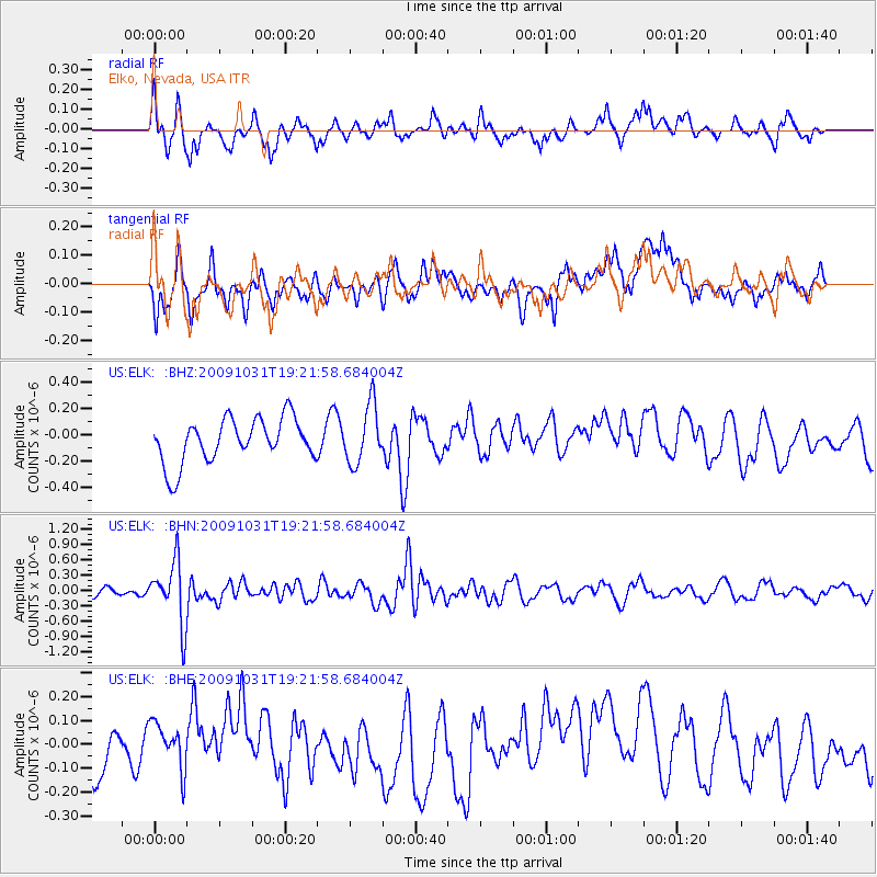
ELK Elko, Nevada, USA - Earthquake Result Viewer
*The percent match for this event was below the threshold and hence no stack was calculated.
| Earthquake location: |
Santa Cruz Islands |
| Earthquake latitude/longitude: |
-11.4/166.4 |
| Earthquake time(UTC): |
2009/10/31 (304) 19:09:51 GMT |
| Earthquake Depth: |
134 km |
| Earthquake Magnitude: |
5.9 MB, 5.9 MW, 5.9 MW |
| Earthquake Catalog/Contributor: |
WHDF/NEIC |
|
| Network: |
US United States National Seismic Network |
| Station: |
ELK Elko, Nevada, USA |
| Lat/Lon: |
40.74 N/115.24 W |
| Elevation: |
2210 m |
|
| Distance: |
88.7 deg |
| Az: |
48.109 deg |
| Baz: |
253.899 deg |
| Ray Param: |
$rayparam |
*The percent match for this event was below the threshold and hence was not used in the summary stack. |
|
| Radial Match: |
64.07709 % |
| Radial Bump: |
400 |
| Transverse Match: |
41.98491 % |
| Transverse Bump: |
400 |
| SOD ConfigId: |
2622 |
| Insert Time: |
2010-03-05 07:20:59.495 +0000 |
| GWidth: |
2.5 |
| Max Bumps: |
400 |
| Tol: |
0.001 |
|
Signal To Noise
| Channel | StoN | STA | LTA |
| US:ELK: :BHN:20091031T19:21:58.684004Z | 3.1978092 | 6.0504397E-7 | 1.8920579E-7 |
| US:ELK: :BHE:20091031T19:21:58.684004Z | 0.6034574 | 9.31788E-8 | 1.5440826E-7 |
| US:ELK: :BHZ:20091031T19:21:58.684004Z | 1.3215878 | 2.2125938E-7 | 1.6741936E-7 |
| Arrivals |
| Ps | |
| PpPs | |
| PsPs/PpSs | |


