You are here: Home > Network List > US - United States National Seismic Network Stations List
> Station ELK Elko, Nevada, USA > Earthquake Result Viewer
ELK Elko, Nevada, USA - Earthquake Result Viewer
*The percent match for this event was below the threshold and hence no stack was calculated.
| Earthquake location: |
Southeast Of Loyalty Islands |
| Earthquake latitude/longitude: |
-23.2/170.6 |
| Earthquake time(UTC): |
2009/02/24 (055) 12:39:41 GMT |
| Earthquake Depth: |
32 km |
| Earthquake Magnitude: |
5.6 MB, 5.7 MW, 5.6 MW |
| Earthquake Catalog/Contributor: |
WHDF/NEIC |
|
| Network: |
US United States National Seismic Network |
| Station: |
ELK Elko, Nevada, USA |
| Lat/Lon: |
40.74 N/115.24 W |
| Elevation: |
2210 m |
|
| Distance: |
93.7 deg |
| Az: |
47.105 deg |
| Baz: |
242.536 deg |
| Ray Param: |
$rayparam |
*The percent match for this event was below the threshold and hence was not used in the summary stack. |
|
| Radial Match: |
51.189243 % |
| Radial Bump: |
400 |
| Transverse Match: |
52.211933 % |
| Transverse Bump: |
400 |
| SOD ConfigId: |
2658 |
| Insert Time: |
2010-03-05 07:21:04.063 +0000 |
| GWidth: |
2.5 |
| Max Bumps: |
400 |
| Tol: |
0.001 |
|
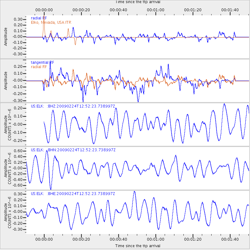
Signal To Noise
| Channel | StoN | STA | LTA |
| US:ELK: :BHN:20090224T12:52:23.738997Z | 1.9670682 | 4.3949296E-7 | 2.2342539E-7 |
| US:ELK: :BHE:20090224T12:52:23.738997Z | 0.5703714 | 8.362951E-8 | 1.466229E-7 |
| US:ELK: :BHZ:20090224T12:52:23.738997Z | 0.9766468 | 1.0311259E-7 | 1.0557818E-7 |
| Arrivals |
| Ps | |
| PpPs | |
| PsPs/PpSs | |


