You are here: Home > Network List > US - United States National Seismic Network Stations List
> Station AMTX Amarillo, Texas, USA > Earthquake Result Viewer
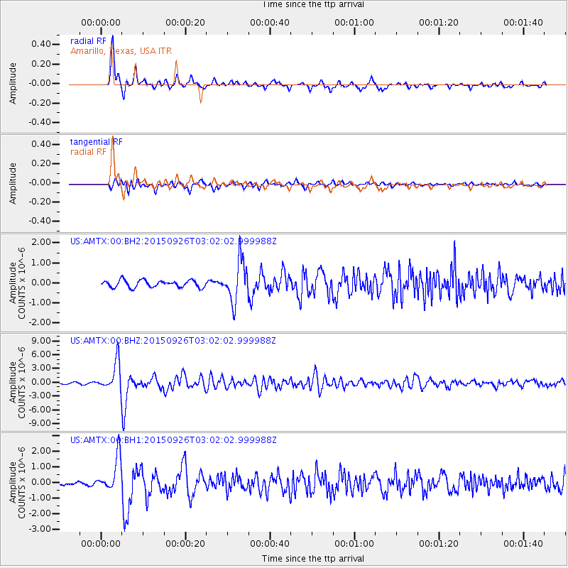
AMTX Amarillo, Texas, USA - Earthquake Result Viewer
*The percent match for this event was below the threshold and hence no stack was calculated.
| Earthquake location: |
Near Coast Of Central Chile |
| Earthquake latitude/longitude: |
-30.8/-71.4 |
| Earthquake time(UTC): |
2015/09/26 (269) 02:51:18 GMT |
| Earthquake Depth: |
38 km |
| Earthquake Magnitude: |
6.2 MO |
| Earthquake Catalog/Contributor: |
NEIC PDE/NEIC ALERT |
|
| Network: |
US United States National Seismic Network |
| Station: |
AMTX Amarillo, Texas, USA |
| Lat/Lon: |
34.53 N/101.41 W |
| Elevation: |
1010 m |
|
| Distance: |
70.9 deg |
| Az: |
334.077 deg |
| Baz: |
152.901 deg |
| Ray Param: |
$rayparam |
*The percent match for this event was below the threshold and hence was not used in the summary stack. |
|
| Radial Match: |
89.8011 % |
| Radial Bump: |
351 |
| Transverse Match: |
82.51783 % |
| Transverse Bump: |
400 |
| SOD ConfigId: |
1156111 |
| Insert Time: |
2015-10-10 03:33:03.614 +0000 |
| GWidth: |
2.5 |
| Max Bumps: |
400 |
| Tol: |
0.001 |
|
Signal To Noise
| Channel | StoN | STA | LTA |
| US:AMTX:00:BHZ:20150926T03:02:02.999988Z | 17.039675 | 3.3423505E-6 | 1.9615108E-7 |
| US:AMTX:00:BH1:20150926T03:02:02.999988Z | 11.519876 | 1.1276384E-6 | 9.788633E-8 |
| US:AMTX:00:BH2:20150926T03:02:02.999988Z | 3.7880213 | 6.484971E-7 | 1.7119679E-7 |
| Arrivals |
| Ps | |
| PpPs | |
| PsPs/PpSs | |


