You are here: Home > Network List > US - United States National Seismic Network Stations List
> Station ELK Elko, Nevada, USA > Earthquake Result Viewer
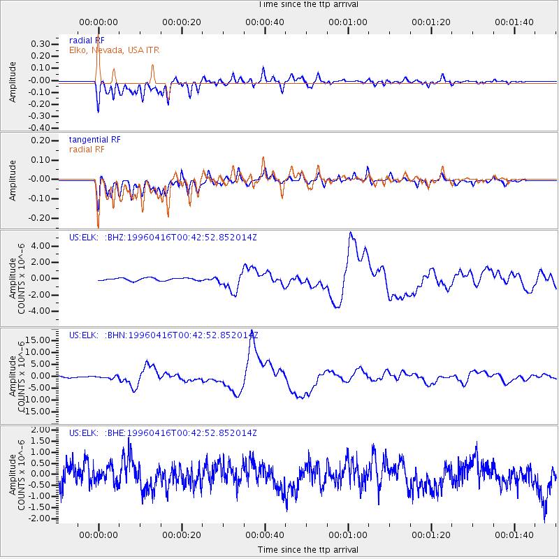
ELK Elko, Nevada, USA - Earthquake Result Viewer
*The percent match for this event was below the threshold and hence no stack was calculated.
| Earthquake location: |
South Of Fiji Islands |
| Earthquake latitude/longitude: |
-24.1/-177.0 |
| Earthquake time(UTC): |
1996/04/16 (107) 00:30:54 GMT |
| Earthquake Depth: |
111 km |
| Earthquake Magnitude: |
6.4 MB, 6.8 MS, 7.1 UNKNOWN, 7.1 MW |
| Earthquake Catalog/Contributor: |
WHDF/NEIC |
|
| Network: |
US United States National Seismic Network |
| Station: |
ELK Elko, Nevada, USA |
| Lat/Lon: |
40.74 N/115.24 W |
| Elevation: |
2210 m |
|
| Distance: |
86.3 deg |
| Az: |
42.143 deg |
| Baz: |
233.832 deg |
| Ray Param: |
$rayparam |
*The percent match for this event was below the threshold and hence was not used in the summary stack. |
|
| Radial Match: |
68.03916 % |
| Radial Bump: |
400 |
| Transverse Match: |
55.193718 % |
| Transverse Bump: |
400 |
| SOD ConfigId: |
4480 |
| Insert Time: |
2010-03-05 07:21:30.193 +0000 |
| GWidth: |
2.5 |
| Max Bumps: |
400 |
| Tol: |
0.001 |
|
Signal To Noise
| Channel | StoN | STA | LTA |
| US:ELK: :BHN:19960416T00:42:52.852014Z | 1.5252852 | 4.5554424E-7 | 2.9866166E-7 |
| US:ELK: :BHE:19960416T00:42:52.852014Z | 0.74646795 | 3.4707247E-7 | 4.6495293E-7 |
| US:ELK: :BHZ:19960416T00:42:52.852014Z | 7.1862884 | 1.1890617E-6 | 1.6546257E-7 |
| Arrivals |
| Ps | |
| PpPs | |
| PsPs/PpSs | |


