You are here: Home > Network List > US - United States National Seismic Network Stations List
> Station ELK Elko, Nevada, USA > Earthquake Result Viewer
ELK Elko, Nevada, USA - Earthquake Result Viewer
*The percent match for this event was below the threshold and hence no stack was calculated.
| Earthquake location: |
Southeast Of Loyalty Islands |
| Earthquake latitude/longitude: |
-22.5/170.8 |
| Earthquake time(UTC): |
2009/01/19 (019) 03:46:37 GMT |
| Earthquake Depth: |
35 km |
| Earthquake Magnitude: |
6.0 MW, 5.3 MB |
| Earthquake Catalog/Contributor: |
WHDF/NEIC |
|
| Network: |
US United States National Seismic Network |
| Station: |
ELK Elko, Nevada, USA |
| Lat/Lon: |
40.74 N/115.24 W |
| Elevation: |
2210 m |
|
| Distance: |
93.0 deg |
| Az: |
46.988 deg |
| Baz: |
242.892 deg |
| Ray Param: |
$rayparam |
*The percent match for this event was below the threshold and hence was not used in the summary stack. |
|
| Radial Match: |
49.58493 % |
| Radial Bump: |
388 |
| Transverse Match: |
51.55986 % |
| Transverse Bump: |
400 |
| SOD ConfigId: |
2658 |
| Insert Time: |
2010-03-05 07:21:43.917 +0000 |
| GWidth: |
2.5 |
| Max Bumps: |
400 |
| Tol: |
0.001 |
|
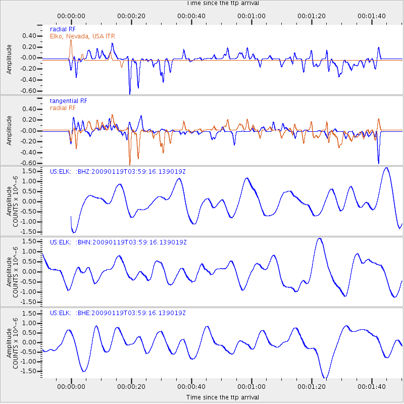
Signal To Noise
| Channel | StoN | STA | LTA |
| US:ELK: :BHN:20090119T03:59:16.139019Z | 0.95809144 | 4.384719E-7 | 4.576514E-7 |
| US:ELK: :BHE:20090119T03:59:16.139019Z | 2.5460985 | 9.297953E-7 | 3.6518435E-7 |
| US:ELK: :BHZ:20090119T03:59:16.139019Z | 0.8645666 | 5.1327004E-7 | 5.9367324E-7 |
| Arrivals |
| Ps | |
| PpPs | |
| PsPs/PpSs | |


