You are here: Home > Network List > IU - Global Seismograph Network (GSN - IRIS/USGS) Stations List
> Station GNI Garni, Armenia > Earthquake Result Viewer
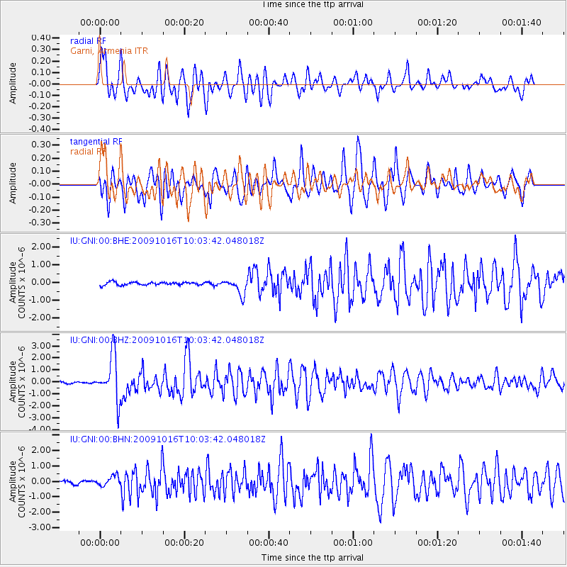
GNI Garni, Armenia - Earthquake Result Viewer
*The percent match for this event was below the threshold and hence no stack was calculated.
| Earthquake location: |
Sunda Strait, Indonesia |
| Earthquake latitude/longitude: |
-6.5/105.2 |
| Earthquake time(UTC): |
2009/10/16 (289) 09:52:50 GMT |
| Earthquake Depth: |
38 km |
| Earthquake Magnitude: |
5.9 MB, 5.8 MS, 6.1 MW, 6.1 MW |
| Earthquake Catalog/Contributor: |
WHDF/NEIC |
|
| Network: |
IU Global Seismograph Network (GSN - IRIS/USGS) |
| Station: |
GNI Garni, Armenia |
| Lat/Lon: |
40.15 N/44.74 E |
| Elevation: |
1609 m |
|
| Distance: |
72.4 deg |
| Az: |
315.586 deg |
| Baz: |
114.884 deg |
| Ray Param: |
$rayparam |
*The percent match for this event was below the threshold and hence was not used in the summary stack. |
|
| Radial Match: |
77.91963 % |
| Radial Bump: |
400 |
| Transverse Match: |
69.23991 % |
| Transverse Bump: |
400 |
| SOD ConfigId: |
1 |
| Insert Time: |
2010-02-19 00:50:34.981 +0000 |
| GWidth: |
2.5 |
| Max Bumps: |
400 |
| Tol: |
0.001 |
|
Signal To Noise
| Channel | StoN | STA | LTA |
| IU:GNI:00:BHZ:20091016T10:03:42.048018Z | 26.202017 | 1.9232245E-6 | 7.339986E-8 |
| IU:GNI:00:BHN:20091016T10:03:42.048018Z | 3.5822515 | 3.3696E-7 | 9.406374E-8 |
| IU:GNI:00:BHE:20091016T10:03:42.048018Z | 5.54698 | 4.5711477E-7 | 8.2407865E-8 |
| Arrivals |
| Ps | |
| PpPs | |
| PsPs/PpSs | |


