You are here: Home > Network List > US - United States National Seismic Network Stations List
> Station ELK Elko, Nevada, USA > Earthquake Result Viewer
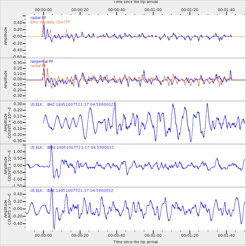
ELK Elko, Nevada, USA - Earthquake Result Viewer
*The percent match for this event was below the threshold and hence no stack was calculated.
| Earthquake location: |
Peru-Ecuador Border Region |
| Earthquake latitude/longitude: |
-2.8/-77.8 |
| Earthquake time(UTC): |
1995/10/07 (280) 21:28:06 GMT |
| Earthquake Depth: |
33 km |
| Earthquake Magnitude: |
5.8 MB, 5.2 MS, 5.8 UNKNOWN |
| Earthquake Catalog/Contributor: |
WHDF/NEIC |
|
| Network: |
US United States National Seismic Network |
| Station: |
ELK Elko, Nevada, USA |
| Lat/Lon: |
40.74 N/115.24 W |
| Elevation: |
2210 m |
|
| Distance: |
55.1 deg |
| Az: |
325.781 deg |
| Baz: |
132.328 deg |
| Ray Param: |
$rayparam |
*The percent match for this event was below the threshold and hence was not used in the summary stack. |
|
| Radial Match: |
59.76868 % |
| Radial Bump: |
301 |
| Transverse Match: |
63.52015 % |
| Transverse Bump: |
400 |
| SOD ConfigId: |
4480 |
| Insert Time: |
2010-03-05 07:22:16.527 +0000 |
| GWidth: |
2.5 |
| Max Bumps: |
400 |
| Tol: |
0.001 |
|
Signal To Noise
| Channel | StoN | STA | LTA |
| US:ELK: :BHN:19951007T21:37:04.566003Z | 2.7392292 | 5.134367E-7 | 1.8743839E-7 |
| US:ELK: :BHE:19951007T21:37:04.566003Z | 2.2382495 | 2.1309766E-7 | 9.5207284E-8 |
| US:ELK: :BHZ:19951007T21:37:04.566003Z | 0.6203582 | 5.7949933E-8 | 9.341366E-8 |
| Arrivals |
| Ps | |
| PpPs | |
| PsPs/PpSs | |


