You are here: Home > Network List > TA - USArray Transportable Network (new EarthScope stations) Stations List
> Station P17K Kvichak River, AK, USA > Earthquake Result Viewer
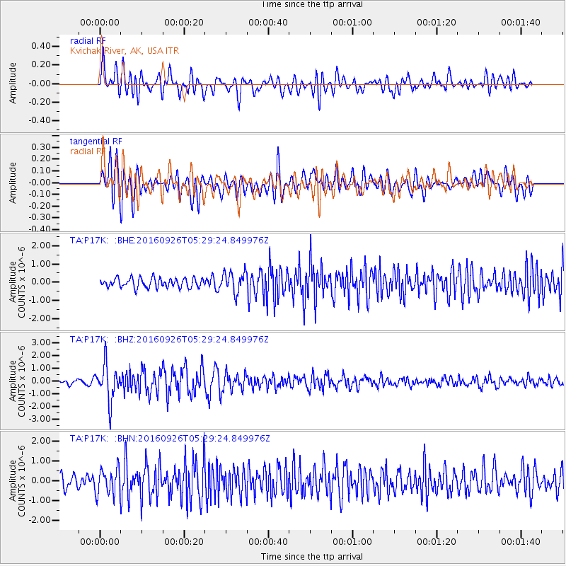
P17K Kvichak River, AK, USA - Earthquake Result Viewer
*The percent match for this event was below the threshold and hence no stack was calculated.
| Earthquake location: |
Ryukyu Islands, Japan |
| Earthquake latitude/longitude: |
27.5/128.6 |
| Earthquake time(UTC): |
2016/09/26 (270) 05:19:58 GMT |
| Earthquake Depth: |
40 km |
| Earthquake Magnitude: |
6.0 MB |
| Earthquake Catalog/Contributor: |
NEIC PDE/NEIC ALERT |
|
| Network: |
TA USArray Transportable Network (new EarthScope stations) |
| Station: |
P17K Kvichak River, AK, USA |
| Lat/Lon: |
59.20 N/156.44 W |
| Elevation: |
91 m |
|
| Distance: |
59.2 deg |
| Az: |
35.355 deg |
| Baz: |
272.601 deg |
| Ray Param: |
$rayparam |
*The percent match for this event was below the threshold and hence was not used in the summary stack. |
|
| Radial Match: |
72.090256 % |
| Radial Bump: |
400 |
| Transverse Match: |
62.741516 % |
| Transverse Bump: |
400 |
| SOD ConfigId: |
11737051 |
| Insert Time: |
2019-04-25 15:43:49.832 +0000 |
| GWidth: |
2.5 |
| Max Bumps: |
400 |
| Tol: |
0.001 |
|
Signal To Noise
| Channel | StoN | STA | LTA |
| TA:P17K: :BHZ:20160926T05:29:24.849976Z | 9.394578 | 1.4560289E-6 | 1.5498608E-7 |
| TA:P17K: :BHN:20160926T05:29:24.849976Z | 2.3189247 | 6.676887E-7 | 2.8793033E-7 |
| TA:P17K: :BHE:20160926T05:29:24.849976Z | 2.172061 | 5.53099E-7 | 2.546425E-7 |
| Arrivals |
| Ps | |
| PpPs | |
| PsPs/PpSs | |


