You are here: Home > Network List > UW - Pacific Northwest Regional Seismic Network Stations List
> Station LEBA Lebam, WA, USA > Earthquake Result Viewer
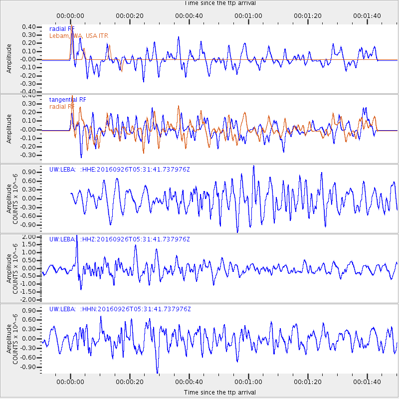
LEBA Lebam, WA, USA - Earthquake Result Viewer
*The percent match for this event was below the threshold and hence no stack was calculated.
| Earthquake location: |
Ryukyu Islands, Japan |
| Earthquake latitude/longitude: |
27.5/128.6 |
| Earthquake time(UTC): |
2016/09/26 (270) 05:19:58 GMT |
| Earthquake Depth: |
40 km |
| Earthquake Magnitude: |
6.0 MB |
| Earthquake Catalog/Contributor: |
NEIC PDE/NEIC ALERT |
|
| Network: |
UW Pacific Northwest Regional Seismic Network |
| Station: |
LEBA Lebam, WA, USA |
| Lat/Lon: |
46.55 N/123.56 W |
| Elevation: |
73 m |
|
| Distance: |
81.7 deg |
| Az: |
41.589 deg |
| Baz: |
301.297 deg |
| Ray Param: |
$rayparam |
*The percent match for this event was below the threshold and hence was not used in the summary stack. |
|
| Radial Match: |
55.038254 % |
| Radial Bump: |
400 |
| Transverse Match: |
63.220768 % |
| Transverse Bump: |
400 |
| SOD ConfigId: |
11737051 |
| Insert Time: |
2019-04-25 15:44:41.141 +0000 |
| GWidth: |
2.5 |
| Max Bumps: |
400 |
| Tol: |
0.001 |
|
Signal To Noise
| Channel | StoN | STA | LTA |
| UW:LEBA: :HHZ:20160926T05:31:41.737976Z | 3.941356 | 7.136097E-7 | 1.810569E-7 |
| UW:LEBA: :HHN:20160926T05:31:41.737976Z | 0.90629923 | 2.1381292E-7 | 2.3591868E-7 |
| UW:LEBA: :HHE:20160926T05:31:41.737976Z | 0.51890594 | 1.721829E-7 | 3.318191E-7 |
| Arrivals |
| Ps | |
| PpPs | |
| PsPs/PpSs | |


