You are here: Home > Network List > UW - Pacific Northwest Regional Seismic Network Stations List
> Station MRBL Marblemount, WA, USA > Earthquake Result Viewer
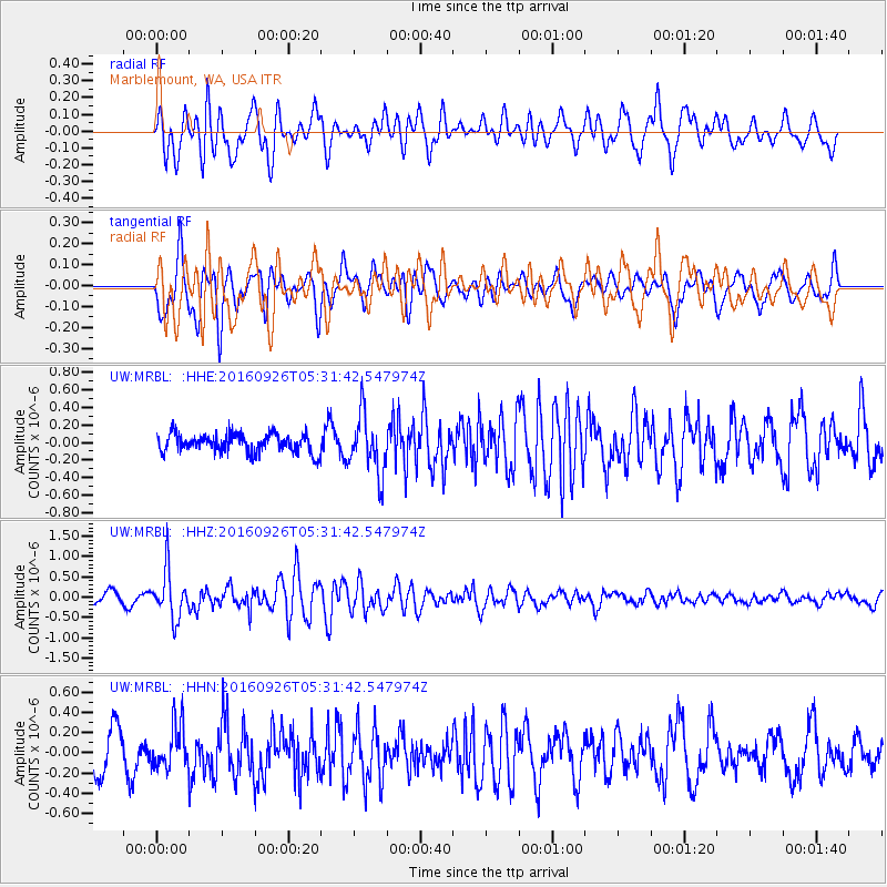
MRBL Marblemount, WA, USA - Earthquake Result Viewer
*The percent match for this event was below the threshold and hence no stack was calculated.
| Earthquake location: |
Ryukyu Islands, Japan |
| Earthquake latitude/longitude: |
27.5/128.6 |
| Earthquake time(UTC): |
2016/09/26 (270) 05:19:58 GMT |
| Earthquake Depth: |
40 km |
| Earthquake Magnitude: |
6.0 MB |
| Earthquake Catalog/Contributor: |
NEIC PDE/NEIC ALERT |
|
| Network: |
UW Pacific Northwest Regional Seismic Network |
| Station: |
MRBL Marblemount, WA, USA |
| Lat/Lon: |
48.52 N/121.48 W |
| Elevation: |
75 m |
|
| Distance: |
81.9 deg |
| Az: |
39.144 deg |
| Baz: |
302.477 deg |
| Ray Param: |
$rayparam |
*The percent match for this event was below the threshold and hence was not used in the summary stack. |
|
| Radial Match: |
71.36116 % |
| Radial Bump: |
400 |
| Transverse Match: |
65.184784 % |
| Transverse Bump: |
400 |
| SOD ConfigId: |
11737051 |
| Insert Time: |
2019-04-25 15:44:44.973 +0000 |
| GWidth: |
2.5 |
| Max Bumps: |
400 |
| Tol: |
0.001 |
|
Signal To Noise
| Channel | StoN | STA | LTA |
| UW:MRBL: :HHZ:20160926T05:31:42.547974Z | 3.8407977 | 5.808508E-7 | 1.5123182E-7 |
| UW:MRBL: :HHN:20160926T05:31:42.547974Z | 1.2225894 | 2.1961479E-7 | 1.7963087E-7 |
| UW:MRBL: :HHE:20160926T05:31:42.547974Z | 3.1913495 | 3.3598127E-7 | 1.0527875E-7 |
| Arrivals |
| Ps | |
| PpPs | |
| PsPs/PpSs | |


