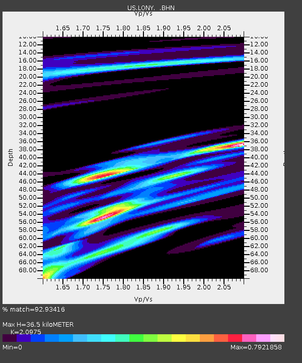
LONY Lake Ozonia, New York, USA - Earthquake Result Viewer
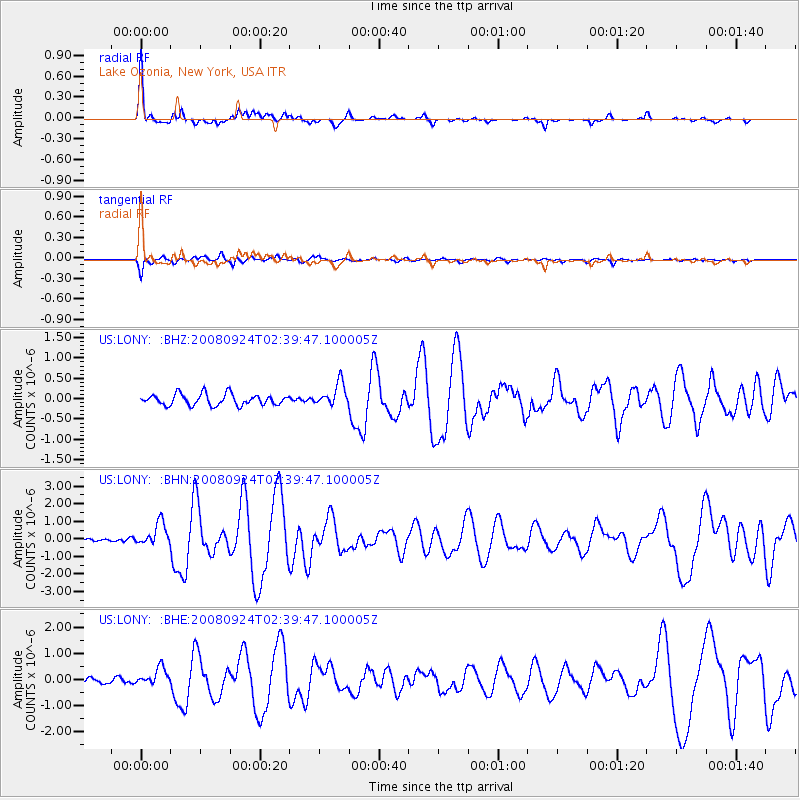
Earthquake location: Off Coast Of Jalisco, Mexico
Earthquake latitude/longitude: 17.6/-105.5
Earthquake time(UTC): 2008/09/24 (268) 02:33:05 GMT
Earthquake Depth: 10 km
Earthquake Magnitude: 5.7 MB, 6.2 MS, 6.4 MW, 6.4 MW
Earthquake Catalog/Contributor: WHDF/NEIC
Network: US United States National Seismic Network
Station: LONY Lake Ozonia, New York, USA
Lat/Lon: 44.62 N/74.58 W
Elevation: 440 m
Distance: 37.4 deg
Az: 37.199 deg
Baz: 233.845 deg
Ray Param: 0.07617518
Estimated Moho Depth: 36.5 km
Estimated Crust Vp/Vs: 2.10
Assumed Crust Vp: 6.419 km/s
Estimated Crust Vs: 3.06 km/s
Estimated Crust Poisson's Ratio: 0.35
Radial Match: 92.93416 %
Radial Bump: 334
Transverse Match: 85.62693 %
Transverse Bump: 400
SOD ConfigId: 2560
Insert Time: 2010-03-05 07:23:07.977 +0000
GWidth: 2.5
Max Bumps: 400
Tol: 0.001

Signal To Noise

ChannelStoNSTALTA
US:LONY: :BHN:20080924T02:39:47.100005Z5.6160116.53867E-71.1642908E-7
US:LONY: :BHE:20080924T02:39:47.100005Z2.59069043.34248E-71.2901889E-7
US:LONY: :BHZ:20080924T02:39:47.100005Z2.07392552.8154324E-71.357538E-7
Arrivals
Ps6.6 SECOND
PpPs17 SECOND
PsPs/PpSs23 SECOND