LONY Lake Ozonia, New York, USA - Earthquake Result Viewer
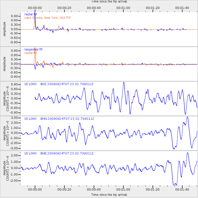
Earthquake location: Off Coast Of Jalisco, Mexico
Earthquake latitude/longitude: 18.8/-107.3
Earthquake time(UTC): 2009/09/24 (267) 07:16:19 GMT
Earthquake Depth: 10 km
Earthquake Magnitude: 5.8 MB, 6.2 MS, 6.3 MW, 6.3 MW
Earthquake Catalog/Contributor: WHDF/NEIC
Network: US United States National Seismic Network
Station: LONY Lake Ozonia, New York, USA
Lat/Lon: 44.62 N/74.58 W
Elevation: 440 m
Distance: 37.5 deg
Az: 39.402 deg
Baz: 237.341 deg
Ray Param: 0.07609961
Estimated Moho Depth: 42.75 km
Estimated Crust Vp/Vs: 1.86
Assumed Crust Vp: 6.419 km/s
Estimated Crust Vs: 3.461 km/s
Estimated Crust Poisson's Ratio: 0.30
Radial Match: 92.77135 %
Radial Bump: 163
Transverse Match: 84.4736 %
Transverse Bump: 369
SOD ConfigId: 2622
Insert Time: 2010-03-05 07:23:21.576 +0000
GWidth: 2.5
Max Bumps: 400
Tol: 0.001

Signal To Noise

ChannelStoNSTALTA
US:LONY: :BHN:20090924T07:23:02.799011Z8.0714357.3605804E-79.119296E-8
US:LONY: :BHE:20090924T07:23:02.799011Z2.1647252.944167E-71.360065E-7
US:LONY: :BHZ:20090924T07:23:02.799011Z2.3721313.30533E-71.393401E-7
Arrivals
Ps6.1 SECOND
PpPs18 SECOND
PsPs/PpSs24 SECOND