
LONY Lake Ozonia, New York, USA - Earthquake Result Viewer
| ||||||||||||||||||
| ||||||||||||||||||
| ||||||||||||||||||
|
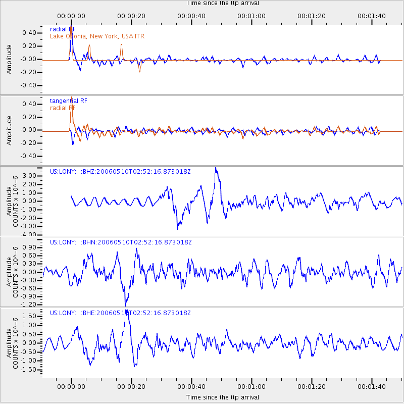
Signal To Noise
| Channel | StoN | STA | LTA |
| US:LONY: :BHN:20060510T02:52:16.873018Z | 1.8228532 | 3.195167E-7 | 1.7528383E-7 |
| US:LONY: :BHE:20060510T02:52:16.873018Z | 1.7608392 | 4.9858727E-7 | 2.831532E-7 |
| US:LONY: :BHZ:20060510T02:52:16.873018Z | 3.152399 | 9.964944E-7 | 3.1610665E-7 |
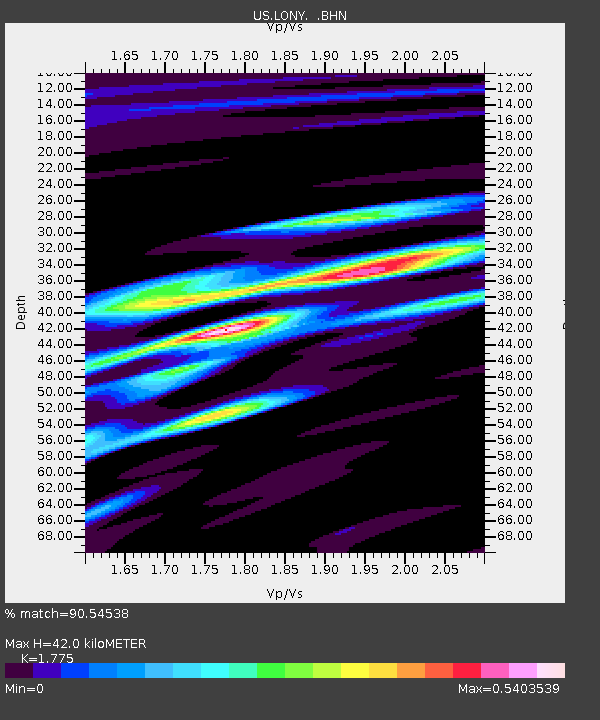
| Arrivals | |
| Ps | 5.3 SECOND |
| PpPs | 17 SECOND |
| PsPs/PpSs | 23 SECOND |

