You are here: Home > Network List > TA - USArray Transportable Network (new EarthScope stations) Stations List
> Station J20K Nowitna River, AK, USA > Earthquake Result Viewer
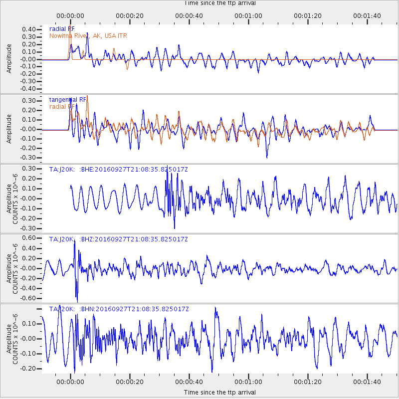
J20K Nowitna River, AK, USA - Earthquake Result Viewer
*The percent match for this event was below the threshold and hence no stack was calculated.
| Earthquake location: |
Dodecanese Islands, Greece |
| Earthquake latitude/longitude: |
36.4/27.6 |
| Earthquake time(UTC): |
2016/09/27 (271) 20:57:08 GMT |
| Earthquake Depth: |
85 km |
| Earthquake Magnitude: |
5.1 Mww |
| Earthquake Catalog/Contributor: |
NEIC PDE/us |
|
| Network: |
TA USArray Transportable Network (new EarthScope stations) |
| Station: |
J20K Nowitna River, AK, USA |
| Lat/Lon: |
64.18 N/154.15 W |
| Elevation: |
314 m |
|
| Distance: |
79.8 deg |
| Az: |
0.784 deg |
| Baz: |
358.556 deg |
| Ray Param: |
$rayparam |
*The percent match for this event was below the threshold and hence was not used in the summary stack. |
|
| Radial Match: |
57.66413 % |
| Radial Bump: |
400 |
| Transverse Match: |
64.32275 % |
| Transverse Bump: |
345 |
| SOD ConfigId: |
11737051 |
| Insert Time: |
2019-04-25 15:53:41.497 +0000 |
| GWidth: |
2.5 |
| Max Bumps: |
400 |
| Tol: |
0.001 |
|
Signal To Noise
| Channel | StoN | STA | LTA |
| TA:J20K: :BHZ:20160927T21:08:35.825017Z | 2.5390477 | 2.4332425E-7 | 9.583288E-8 |
| TA:J20K: :BHN:20160927T21:08:35.825017Z | 1.4272156 | 9.956211E-8 | 6.9759686E-8 |
| TA:J20K: :BHE:20160927T21:08:35.825017Z | 1.4628935 | 1.2789361E-7 | 8.742511E-8 |
| Arrivals |
| Ps | |
| PpPs | |
| PsPs/PpSs | |


