You are here: Home > Network List > US - United States National Seismic Network Stations List
> Station EGMT Eagleton, Montana, USA > Earthquake Result Viewer
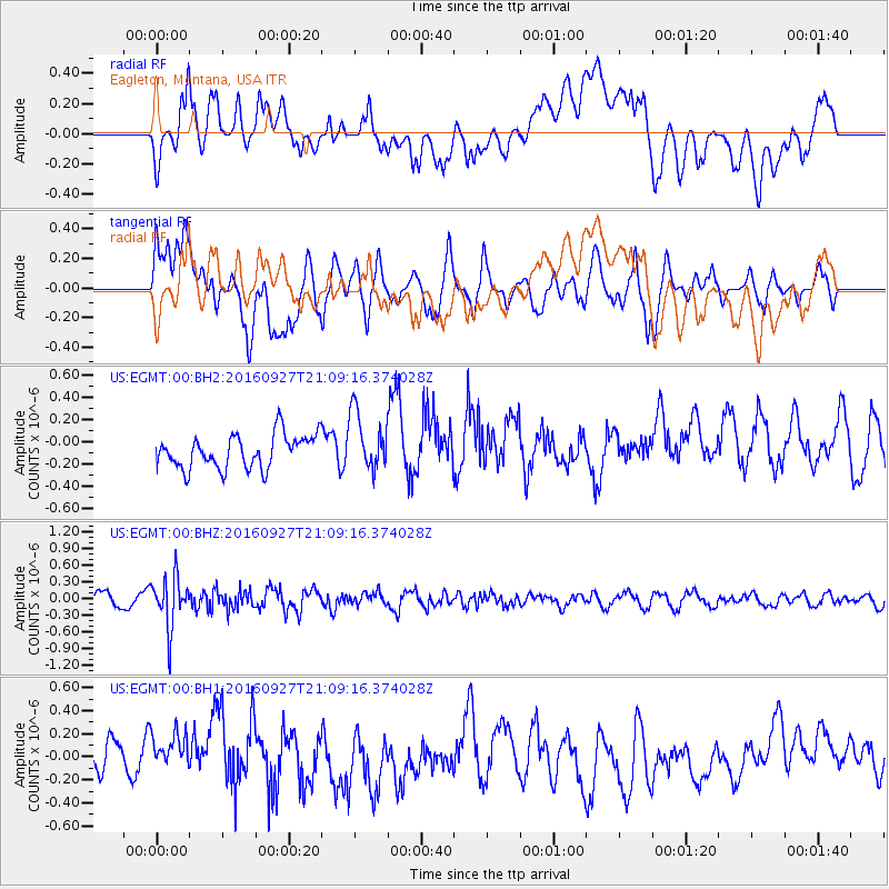
EGMT Eagleton, Montana, USA - Earthquake Result Viewer
*The percent match for this event was below the threshold and hence no stack was calculated.
| Earthquake location: |
Dodecanese Islands, Greece |
| Earthquake latitude/longitude: |
36.4/27.6 |
| Earthquake time(UTC): |
2016/09/27 (271) 20:57:08 GMT |
| Earthquake Depth: |
85 km |
| Earthquake Magnitude: |
5.1 Mww |
| Earthquake Catalog/Contributor: |
NEIC PDE/us |
|
| Network: |
US United States National Seismic Network |
| Station: |
EGMT Eagleton, Montana, USA |
| Lat/Lon: |
48.02 N/109.75 W |
| Elevation: |
1055 m |
|
| Distance: |
87.7 deg |
| Az: |
332.935 deg |
| Baz: |
33.156 deg |
| Ray Param: |
$rayparam |
*The percent match for this event was below the threshold and hence was not used in the summary stack. |
|
| Radial Match: |
47.60042 % |
| Radial Bump: |
400 |
| Transverse Match: |
58.94009 % |
| Transverse Bump: |
400 |
| SOD ConfigId: |
11737051 |
| Insert Time: |
2019-04-25 15:54:30.518 +0000 |
| GWidth: |
2.5 |
| Max Bumps: |
400 |
| Tol: |
0.001 |
|
Signal To Noise
| Channel | StoN | STA | LTA |
| US:EGMT:00:BHZ:20160927T21:09:16.374028Z | 3.3867927 | 4.4867318E-7 | 1.324773E-7 |
| US:EGMT:00:BH1:20160927T21:09:16.374028Z | 1.0832727 | 2.226924E-7 | 2.0557371E-7 |
| US:EGMT:00:BH2:20160927T21:09:16.374028Z | 1.7746301 | 2.6458434E-7 | 1.4909267E-7 |
| Arrivals |
| Ps | |
| PpPs | |
| PsPs/PpSs | |


