You are here: Home > Network List > US - United States National Seismic Network Stations List
> Station LONY Lake Ozonia, New York, USA > Earthquake Result Viewer
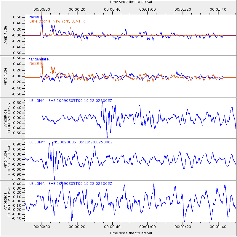
LONY Lake Ozonia, New York, USA - Earthquake Result Viewer
*The percent match for this event was below the threshold and hence no stack was calculated.
| Earthquake location: |
Gulf Of California |
| Earthquake latitude/longitude: |
29.6/-113.8 |
| Earthquake time(UTC): |
2009/08/05 (217) 09:13:12 GMT |
| Earthquake Depth: |
10 km |
| Earthquake Magnitude: |
5.5 MB, 5.6 MS, 5.7 MW |
| Earthquake Catalog/Contributor: |
WHDF/NEIC |
|
| Network: |
US United States National Seismic Network |
| Station: |
LONY Lake Ozonia, New York, USA |
| Lat/Lon: |
44.62 N/74.58 W |
| Elevation: |
440 m |
|
| Distance: |
34.3 deg |
| Az: |
53.218 deg |
| Baz: |
257.581 deg |
| Ray Param: |
$rayparam |
*The percent match for this event was below the threshold and hence was not used in the summary stack. |
|
| Radial Match: |
76.44151 % |
| Radial Bump: |
400 |
| Transverse Match: |
54.74887 % |
| Transverse Bump: |
400 |
| SOD ConfigId: |
2622 |
| Insert Time: |
2010-03-05 07:24:18.226 +0000 |
| GWidth: |
2.5 |
| Max Bumps: |
400 |
| Tol: |
0.001 |
|
Signal To Noise
| Channel | StoN | STA | LTA |
| US:LONY: :BHN:20090805T09:19:28.025006Z | 4.0969653 | 4.2064173E-7 | 1.02671535E-7 |
| US:LONY: :BHE:20090805T09:19:28.025006Z | 1.7624195 | 1.459891E-7 | 8.283449E-8 |
| US:LONY: :BHZ:20090805T09:19:28.025006Z | 3.3518763 | 2.79722E-7 | 8.345237E-8 |
| Arrivals |
| Ps | |
| PpPs | |
| PsPs/PpSs | |


