You are here: Home > Network List > AV - Alaska Volcano Observatory Stations List
> Station MAPS Pakushin Southeast, Makushin Volcano, Alaska > Earthquake Result Viewer
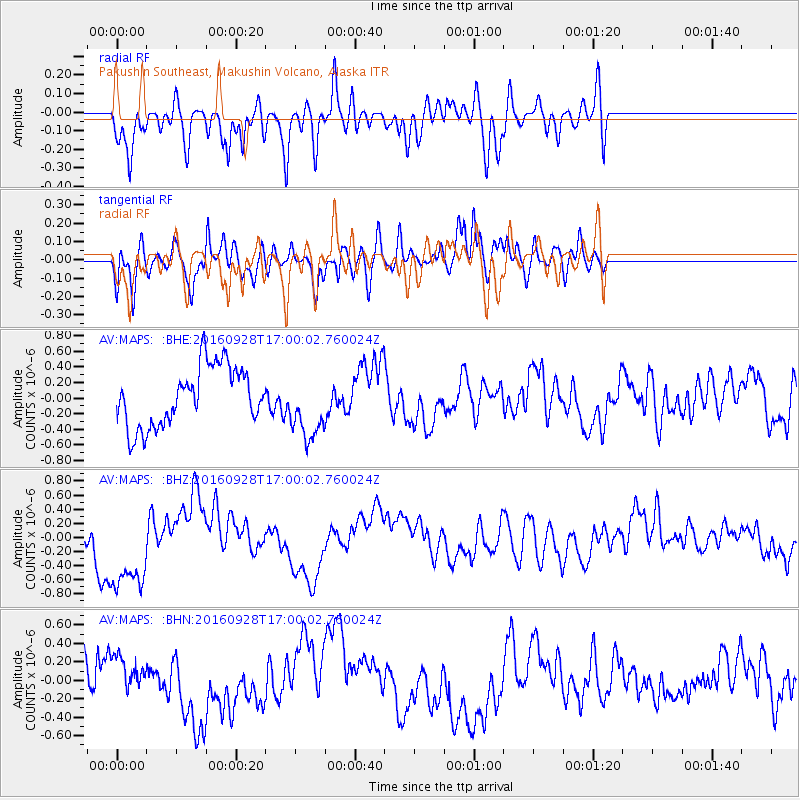
MAPS Pakushin Southeast, Makushin Volcano, Alaska - Earthquake Result Viewer
*The percent match for this event was below the threshold and hence no stack was calculated.
| Earthquake location: |
Nicaragua |
| Earthquake latitude/longitude: |
12.4/-86.5 |
| Earthquake time(UTC): |
2016/09/28 (272) 16:48:55 GMT |
| Earthquake Depth: |
7.6 km |
| Earthquake Magnitude: |
5.5 mww |
| Earthquake Catalog/Contributor: |
NEIC PDE/us |
|
| Network: |
AV Alaska Volcano Observatory |
| Station: |
MAPS Pakushin Southeast, Makushin Volcano, Alaska |
| Lat/Lon: |
53.81 N/166.94 W |
| Elevation: |
333 m |
|
| Distance: |
74.4 deg |
| Az: |
322.617 deg |
| Baz: |
90.229 deg |
| Ray Param: |
$rayparam |
*The percent match for this event was below the threshold and hence was not used in the summary stack. |
|
| Radial Match: |
54.468304 % |
| Radial Bump: |
400 |
| Transverse Match: |
55.161106 % |
| Transverse Bump: |
400 |
| SOD ConfigId: |
11737051 |
| Insert Time: |
2019-04-25 15:57:47.891 +0000 |
| GWidth: |
2.5 |
| Max Bumps: |
400 |
| Tol: |
0.001 |
|
Signal To Noise
| Channel | StoN | STA | LTA |
| AV:MAPS: :BHZ:20160928T17:00:02.760024Z | 3.3490224 | 6.886557E-7 | 2.0562887E-7 |
| AV:MAPS: :BHN:20160928T17:00:02.760024Z | 0.68565524 | 1.9010025E-7 | 2.7725343E-7 |
| AV:MAPS: :BHE:20160928T17:00:02.760024Z | 1.1083958 | 4.20208E-7 | 3.791137E-7 |
| Arrivals |
| Ps | |
| PpPs | |
| PsPs/PpSs | |


