You are here: Home > Network List > TA - USArray Transportable Network (new EarthScope stations) Stations List
> Station J26L Joseph Creek, AK, USA > Earthquake Result Viewer
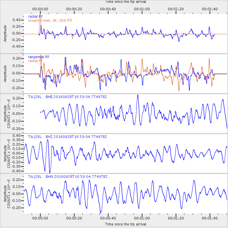
J26L Joseph Creek, AK, USA - Earthquake Result Viewer
*The percent match for this event was below the threshold and hence no stack was calculated.
| Earthquake location: |
Nicaragua |
| Earthquake latitude/longitude: |
12.4/-86.5 |
| Earthquake time(UTC): |
2016/09/28 (272) 16:48:55 GMT |
| Earthquake Depth: |
7.6 km |
| Earthquake Magnitude: |
5.5 mww |
| Earthquake Catalog/Contributor: |
NEIC PDE/us |
|
| Network: |
TA USArray Transportable Network (new EarthScope stations) |
| Station: |
J26L Joseph Creek, AK, USA |
| Lat/Lon: |
64.50 N/143.56 W |
| Elevation: |
1144 m |
|
| Distance: |
65.0 deg |
| Az: |
336.369 deg |
| Baz: |
115.234 deg |
| Ray Param: |
$rayparam |
*The percent match for this event was below the threshold and hence was not used in the summary stack. |
|
| Radial Match: |
60.27594 % |
| Radial Bump: |
400 |
| Transverse Match: |
56.276306 % |
| Transverse Bump: |
400 |
| SOD ConfigId: |
11737051 |
| Insert Time: |
2019-04-25 16:03:13.162 +0000 |
| GWidth: |
2.5 |
| Max Bumps: |
400 |
| Tol: |
0.001 |
|
Signal To Noise
| Channel | StoN | STA | LTA |
| TA:J26L: :BHZ:20160928T16:59:04.774978Z | 2.6793277 | 2.3335743E-7 | 8.7095515E-8 |
| TA:J26L: :BHN:20160928T16:59:04.774978Z | 1.0565395 | 6.51811E-8 | 6.169301E-8 |
| TA:J26L: :BHE:20160928T16:59:04.774978Z | 1.0112171 | 7.0215776E-8 | 6.9436894E-8 |
| Arrivals |
| Ps | |
| PpPs | |
| PsPs/PpSs | |


