You are here: Home > Network List > CI - Caltech Regional Seismic Network Stations List
> Station MPP McPhearson Peak > Earthquake Result Viewer
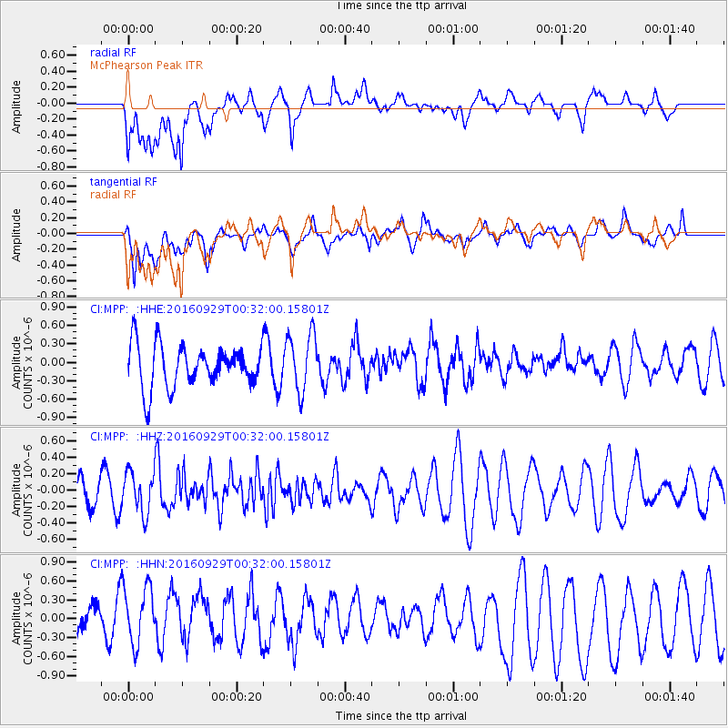
MPP McPhearson Peak - Earthquake Result Viewer
*The percent match for this event was below the threshold and hence no stack was calculated.
| Earthquake location: |
Southeast Of Easter Island |
| Earthquake latitude/longitude: |
-35.6/-103.9 |
| Earthquake time(UTC): |
2016/09/29 (273) 00:21:09 GMT |
| Earthquake Depth: |
10 km |
| Earthquake Magnitude: |
5.5 Mwc |
| Earthquake Catalog/Contributor: |
NEIC PDE/us |
|
| Network: |
CI Caltech Regional Seismic Network |
| Station: |
MPP McPhearson Peak |
| Lat/Lon: |
34.89 N/119.81 W |
| Elevation: |
1739 m |
|
| Distance: |
71.7 deg |
| Az: |
346.262 deg |
| Baz: |
166.384 deg |
| Ray Param: |
$rayparam |
*The percent match for this event was below the threshold and hence was not used in the summary stack. |
|
| Radial Match: |
58.614967 % |
| Radial Bump: |
400 |
| Transverse Match: |
70.351036 % |
| Transverse Bump: |
400 |
| SOD ConfigId: |
11737051 |
| Insert Time: |
2019-04-25 16:06:53.519 +0000 |
| GWidth: |
2.5 |
| Max Bumps: |
400 |
| Tol: |
0.001 |
|
Signal To Noise
| Channel | StoN | STA | LTA |
| CI:MPP: :HHZ:20160929T00:32:00.15801Z | 0.9518605 | 2.4992292E-7 | 2.6256254E-7 |
| CI:MPP: :HHN:20160929T00:32:00.15801Z | 1.5704826 | 5.2546244E-7 | 3.345866E-7 |
| CI:MPP: :HHE:20160929T00:32:00.15801Z | 1.3965905 | 4.80221E-7 | 3.438524E-7 |
| Arrivals |
| Ps | |
| PpPs | |
| PsPs/PpSs | |


