You are here: Home > Network List > G - GEOSCOPE Stations List
> Station MPG Montagne des Peres, French Guyana > Earthquake Result Viewer
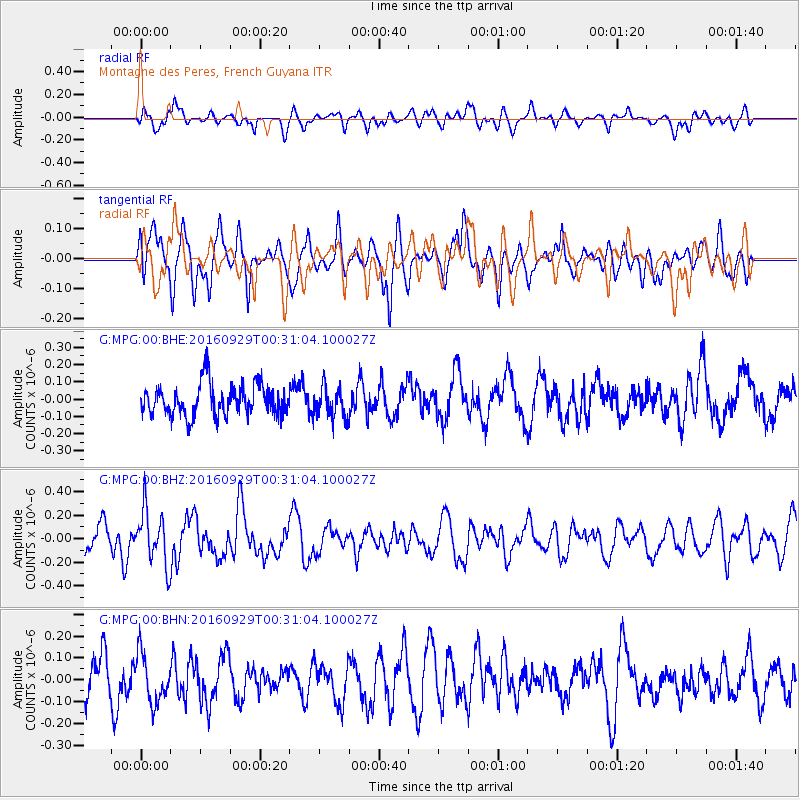
MPG Montagne des Peres, French Guyana - Earthquake Result Viewer
*The percent match for this event was below the threshold and hence no stack was calculated.
| Earthquake location: |
Southeast Of Easter Island |
| Earthquake latitude/longitude: |
-35.6/-103.9 |
| Earthquake time(UTC): |
2016/09/29 (273) 00:21:09 GMT |
| Earthquake Depth: |
10 km |
| Earthquake Magnitude: |
5.5 Mwc |
| Earthquake Catalog/Contributor: |
NEIC PDE/us |
|
| Network: |
G GEOSCOPE |
| Station: |
MPG Montagne des Peres, French Guyana |
| Lat/Lon: |
5.11 N/52.64 W |
| Elevation: |
147 m |
|
| Distance: |
62.8 deg |
| Az: |
60.842 deg |
| Baz: |
225.6 deg |
| Ray Param: |
$rayparam |
*The percent match for this event was below the threshold and hence was not used in the summary stack. |
|
| Radial Match: |
66.003334 % |
| Radial Bump: |
400 |
| Transverse Match: |
65.85455 % |
| Transverse Bump: |
400 |
| SOD ConfigId: |
11737051 |
| Insert Time: |
2019-04-25 16:07:48.795 +0000 |
| GWidth: |
2.5 |
| Max Bumps: |
400 |
| Tol: |
0.001 |
|
Signal To Noise
| Channel | StoN | STA | LTA |
| G:MPG:00:BHZ:20160929T00:31:04.100027Z | 1.7986015 | 2.2840494E-7 | 1.269903E-7 |
| G:MPG:00:BHN:20160929T00:31:04.100027Z | 1.3160381 | 1.118826E-7 | 8.501471E-8 |
| G:MPG:00:BHE:20160929T00:31:04.100027Z | 0.9525737 | 8.733212E-8 | 9.1680164E-8 |
| Arrivals |
| Ps | |
| PpPs | |
| PsPs/PpSs | |


