EGMT Eagleton, Montana, USA - Earthquake Result Viewer
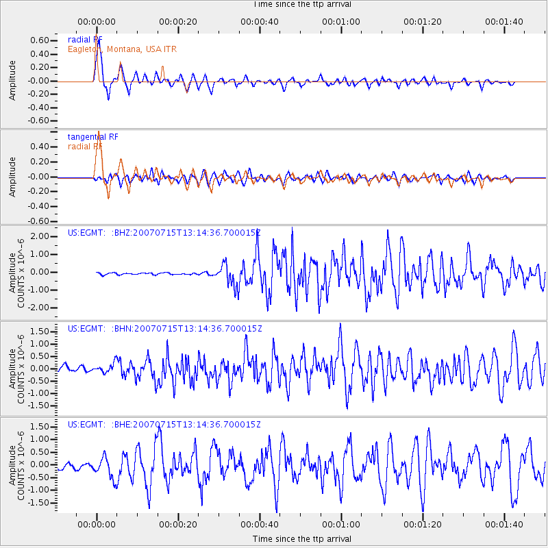
Earthquake location: Fox Islands, Aleutian Islands
Earthquake latitude/longitude: 52.5/-168.0
Earthquake time(UTC): 2007/07/15 (196) 13:08:00 GMT
Earthquake Depth: 10 km
Earthquake Magnitude: 5.8 MB, 5.9 MS, 6.1 MW, 6.0 MW
Earthquake Catalog/Contributor: WHDF/NEIC
Network: US United States National Seismic Network
Station: EGMT Eagleton, Montana, USA
Lat/Lon: 48.02 N/109.75 W
Elevation: 1055 m
Distance: 36.7 deg
Az: 73.038 deg
Baz: 299.37 deg
Ray Param: 0.0765593
Estimated Moho Depth: 38.5 km
Estimated Crust Vp/Vs: 1.95
Assumed Crust Vp: 6.438 km/s
Estimated Crust Vs: 3.31 km/s
Estimated Crust Poisson's Ratio: 0.32
Radial Match: 90.5757 %
Radial Bump: 400
Transverse Match: 69.60825 %
Transverse Bump: 400
SOD ConfigId: 2564
Insert Time: 2010-03-05 07:25:21.795 +0000
GWidth: 2.5
Max Bumps: 400
Tol: 0.001

Signal To Noise

ChannelStoNSTALTA
US:EGMT: :BHN:20070715T13:14:36.700015Z1.58320281.8814247E-71.188366E-7
US:EGMT: :BHE:20070715T13:14:36.700015Z4.80937534.1370077E-78.6019654E-8
US:EGMT: :BHZ:20070715T13:14:36.700015Z13.2726466.268276E-74.722703E-8
Arrivals
Ps6.0 SECOND
PpPs16 SECOND
PsPs/PpSs23 SECOND