You are here: Home > Network List > AV - Alaska Volcano Observatory Stations List
> Station SPCN Ckakachatna North Broadband, Mount Spurr, Alaska > Earthquake Result Viewer
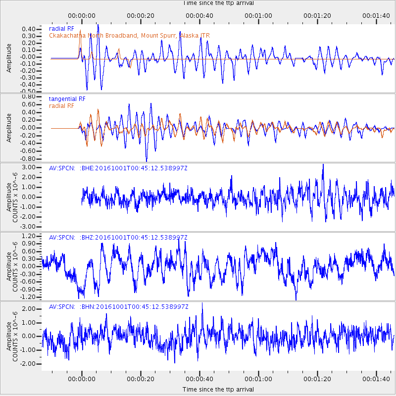
SPCN Ckakachatna North Broadband, Mount Spurr, Alaska - Earthquake Result Viewer
*The percent match for this event was below the threshold and hence no stack was calculated.
| Earthquake location: |
Tonga Islands Region |
| Earthquake latitude/longitude: |
-23.7/-174.9 |
| Earthquake time(UTC): |
2016/10/01 (275) 00:33:04 GMT |
| Earthquake Depth: |
35 km |
| Earthquake Magnitude: |
5.6 MWC, 5.6 MWC |
| Earthquake Catalog/Contributor: |
NEIC PDE/NEIC COMCAT |
|
| Network: |
AV Alaska Volcano Observatory |
| Station: |
SPCN Ckakachatna North Broadband, Mount Spurr, Alaska |
| Lat/Lon: |
61.22 N/152.19 W |
| Elevation: |
735 m |
|
| Distance: |
86.6 deg |
| Az: |
10.786 deg |
| Baz: |
200.764 deg |
| Ray Param: |
$rayparam |
*The percent match for this event was below the threshold and hence was not used in the summary stack. |
|
| Radial Match: |
55.621742 % |
| Radial Bump: |
400 |
| Transverse Match: |
63.346527 % |
| Transverse Bump: |
400 |
| SOD ConfigId: |
11737051 |
| Insert Time: |
2019-04-25 16:17:16.014 +0000 |
| GWidth: |
2.5 |
| Max Bumps: |
400 |
| Tol: |
0.001 |
|
Signal To Noise
| Channel | StoN | STA | LTA |
| AV:SPCN: :BHZ:20161001T00:45:12.538997Z | 3.1137757 | 8.098569E-7 | 2.6008837E-7 |
| AV:SPCN: :BHN:20161001T00:45:12.538997Z | 0.8995743 | 4.9558616E-7 | 5.5091186E-7 |
| AV:SPCN: :BHE:20161001T00:45:12.538997Z | 0.9555956 | 5.30148E-7 | 5.547828E-7 |
| Arrivals |
| Ps | |
| PpPs | |
| PsPs/PpSs | |


