EGMT Eagleton, Montana, USA - Earthquake Result Viewer
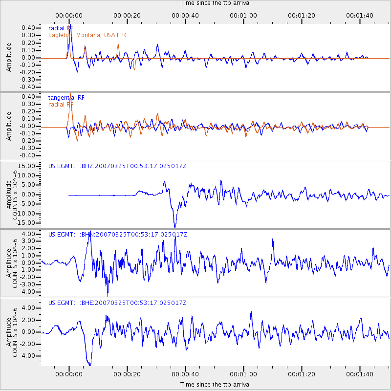
Earthquake location: Near West Coast Of Honshu, Japan
Earthquake latitude/longitude: 37.3/136.6
Earthquake time(UTC): 2007/03/25 (084) 00:41:57 GMT
Earthquake Depth: 8.0 km
Earthquake Magnitude: 6.1 MB, 6.8 MS, 6.7 MW, 6.6 MW
Earthquake Catalog/Contributor: WHDF/NEIC
Network: US United States National Seismic Network
Station: EGMT Eagleton, Montana, USA
Lat/Lon: 48.02 N/109.75 W
Elevation: 1055 m
Distance: 76.5 deg
Az: 39.218 deg
Baz: 311.348 deg
Ray Param: 0.050935175
Estimated Moho Depth: 47.0 km
Estimated Crust Vp/Vs: 1.74
Assumed Crust Vp: 6.438 km/s
Estimated Crust Vs: 3.705 km/s
Estimated Crust Poisson's Ratio: 0.25
Radial Match: 92.9576 %
Radial Bump: 400
Transverse Match: 77.23829 %
Transverse Bump: 400
SOD ConfigId: 2564
Insert Time: 2010-03-05 07:25:28.416 +0000
GWidth: 2.5
Max Bumps: 400
Tol: 0.001

Signal To Noise

ChannelStoNSTALTA
US:EGMT: :BHN:20070325T00:53:17.025017Z4.09859041.2002172E-62.928366E-7
US:EGMT: :BHE:20070325T00:53:17.025017Z4.1496241.0135237E-62.4424475E-7
US:EGMT: :BHZ:20070325T00:53:17.025017Z5.78204252.9523278E-65.106029E-7
Arrivals
Ps5.6 SECOND
PpPs19 SECOND
PsPs/PpSs25 SECOND