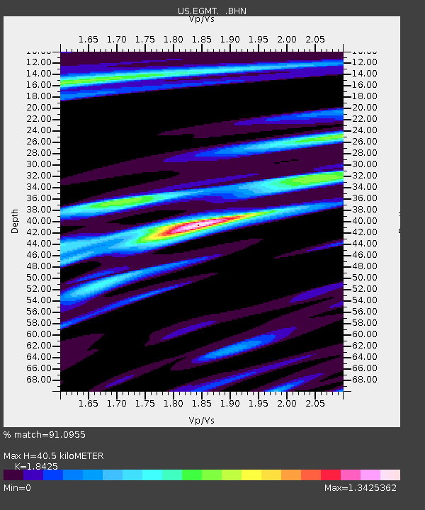
EGMT Eagleton, Montana, USA - Earthquake Result Viewer
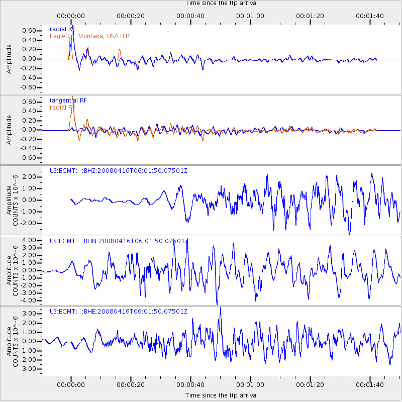
Earthquake location: Andreanof Islands, Aleutian Is.
Earthquake latitude/longitude: 51.9/-179.2
Earthquake time(UTC): 2008/04/16 (107) 05:54:19 GMT
Earthquake Depth: 13 km
Earthquake Magnitude: 6.1 MB, 6.5 MS, 6.6 MW, 6.6 MW
Earthquake Catalog/Contributor: WHDF/NEIC
Network: US United States National Seismic Network
Station: EGMT Eagleton, Montana, USA
Lat/Lon: 48.02 N/109.75 W
Elevation: 1055 m
Distance: 43.3 deg
Az: 66.425 deg
Baz: 302.181 deg
Ray Param: 0.07264201
Estimated Moho Depth: 40.5 km
Estimated Crust Vp/Vs: 1.84
Assumed Crust Vp: 6.438 km/s
Estimated Crust Vs: 3.494 km/s
Estimated Crust Poisson's Ratio: 0.29
Radial Match: 91.0955 %
Radial Bump: 339
Transverse Match: 72.75765 %
Transverse Bump: 400
SOD ConfigId: 2504
Insert Time: 2010-03-05 07:25:32.168 +0000
GWidth: 2.5
Max Bumps: 400
Tol: 0.001

Signal To Noise

ChannelStoNSTALTA
US:EGMT: :BHN:20080416T06:01:50.07501Z4.89651167.259167E-71.4825181E-7
US:EGMT: :BHE:20080416T06:01:50.07501Z1.43559033.692791E-72.5723156E-7
US:EGMT: :BHZ:20080416T06:01:50.07501Z3.36860164.954288E-71.4707256E-7
Arrivals
Ps5.7 SECOND
PpPs17 SECOND
PsPs/PpSs22 SECOND