EGMT Eagleton, Montana, USA - Earthquake Result Viewer
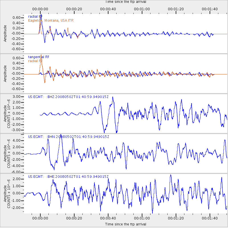
Earthquake location: Andreanof Islands, Aleutian Is.
Earthquake latitude/longitude: 51.9/-177.5
Earthquake time(UTC): 2008/05/02 (123) 01:33:37 GMT
Earthquake Depth: 14 km
Earthquake Magnitude: 6.3 MB, 6.8 MS, 6.6 MW, 6.6 MW
Earthquake Catalog/Contributor: WHDF/NEIC
Network: US United States National Seismic Network
Station: EGMT Eagleton, Montana, USA
Lat/Lon: 48.02 N/109.75 W
Elevation: 1055 m
Distance: 42.4 deg
Az: 67.265 deg
Baz: 301.575 deg
Ray Param: 0.07321067
Estimated Moho Depth: 16.75 km
Estimated Crust Vp/Vs: 1.60
Assumed Crust Vp: 6.438 km/s
Estimated Crust Vs: 4.023 km/s
Estimated Crust Poisson's Ratio: 0.18
Radial Match: 93.543655 %
Radial Bump: 363
Transverse Match: 73.57881 %
Transverse Bump: 400
SOD ConfigId: 2504
Insert Time: 2010-03-05 07:25:33.599 +0000
GWidth: 2.5
Max Bumps: 400
Tol: 0.001

Signal To Noise

ChannelStoNSTALTA
US:EGMT: :BHN:20080502T01:40:59.949015Z20.106521.8539431E-69.2206065E-8
US:EGMT: :BHE:20080502T01:40:59.949015Z3.4553455.4705106E-71.5832025E-7
US:EGMT: :BHZ:20080502T01:40:59.949015Z4.90493737.396634E-71.5079976E-7
Arrivals
Ps1.7 SECOND
PpPs6.3 SECOND
PsPs/PpSs8.0 SECOND