EGMT Eagleton, Montana, USA - Earthquake Result Viewer
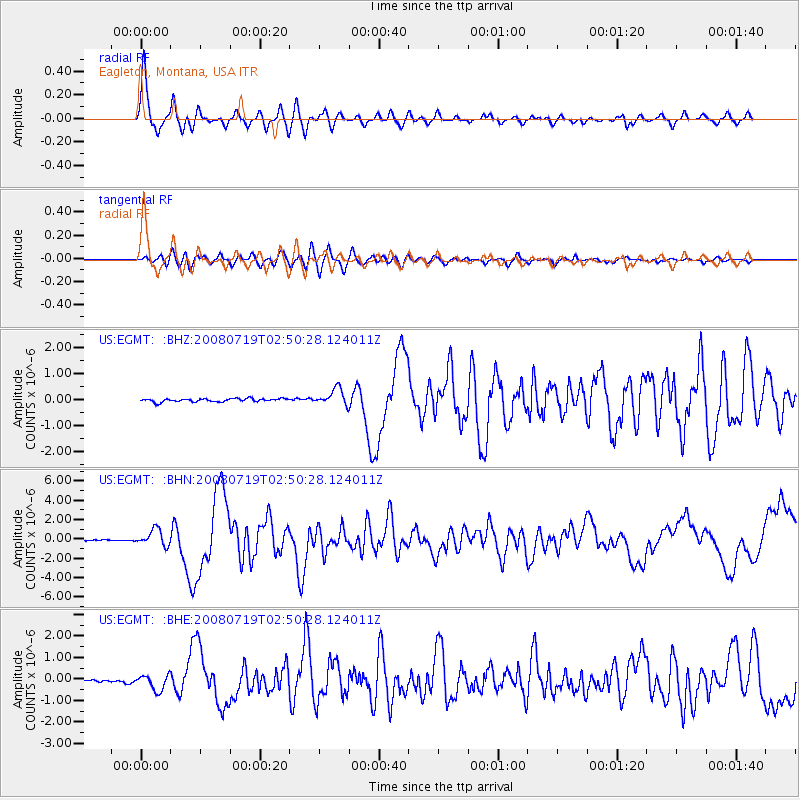
Earthquake location: Off East Coast Of Honshu, Japan
Earthquake latitude/longitude: 37.6/142.2
Earthquake time(UTC): 2008/07/19 (201) 02:39:28 GMT
Earthquake Depth: 22 km
Earthquake Magnitude: 6.2 MB, 7.0 MS, 7.0 MW, 6.9 MW
Earthquake Catalog/Contributor: WHDF/NEIC
Network: US United States National Seismic Network
Station: EGMT Eagleton, Montana, USA
Lat/Lon: 48.02 N/109.75 W
Elevation: 1055 m
Distance: 73.5 deg
Az: 41.75 deg
Baz: 307.967 deg
Ray Param: 0.052965485
Estimated Moho Depth: 36.25 km
Estimated Crust Vp/Vs: 1.91
Assumed Crust Vp: 6.438 km/s
Estimated Crust Vs: 3.362 km/s
Estimated Crust Poisson's Ratio: 0.31
Radial Match: 96.09146 %
Radial Bump: 400
Transverse Match: 88.5464 %
Transverse Bump: 400
SOD ConfigId: 2504
Insert Time: 2010-03-05 07:25:41.360 +0000
GWidth: 2.5
Max Bumps: 400
Tol: 0.001

Signal To Noise

ChannelStoNSTALTA
US:EGMT: :BHN:20080719T02:50:28.124011Z15.4866118.4945736E-75.485108E-8
US:EGMT: :BHE:20080719T02:50:28.124011Z4.3684933.5398983E-78.103248E-8
US:EGMT: :BHZ:20080719T02:50:28.124011Z5.14227063.1668793E-76.158523E-8
Arrivals
Ps5.3 SECOND
PpPs16 SECOND
PsPs/PpSs21 SECOND