
EGMT Eagleton, Montana, USA - Earthquake Result Viewer
| ||||||||||||||||||
| ||||||||||||||||||
| ||||||||||||||||||
|
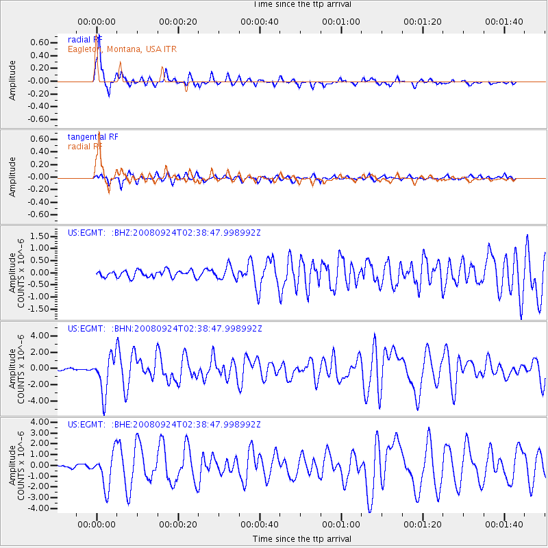
Signal To Noise
| Channel | StoN | STA | LTA |
| US:EGMT: :BHN:20080924T02:38:47.998992Z | 27.590202 | 2.3928549E-6 | 8.672843E-8 |
| US:EGMT: :BHE:20080924T02:38:47.998992Z | 12.214154 | 1.6711657E-6 | 1.3682205E-7 |
| US:EGMT: :BHZ:20080924T02:38:47.998992Z | 1.9474397 | 2.6902464E-7 | 1.3814274E-7 |
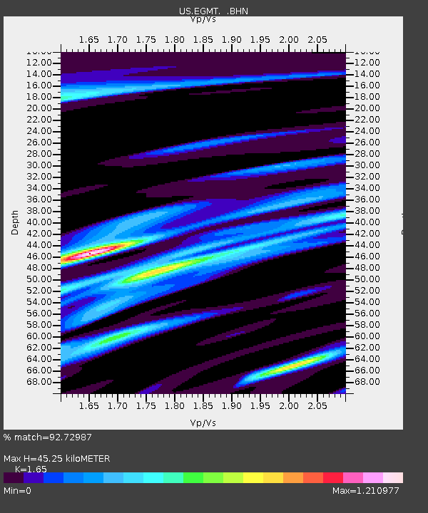
| Arrivals | |
| Ps | 5.0 SECOND |
| PpPs | 17 SECOND |
| PsPs/PpSs | 22 SECOND |

