You are here: Home > Network List > TA - USArray Transportable Network (new EarthScope stations) Stations List
> Station F26K Sheenjek River, AK, USA > Earthquake Result Viewer
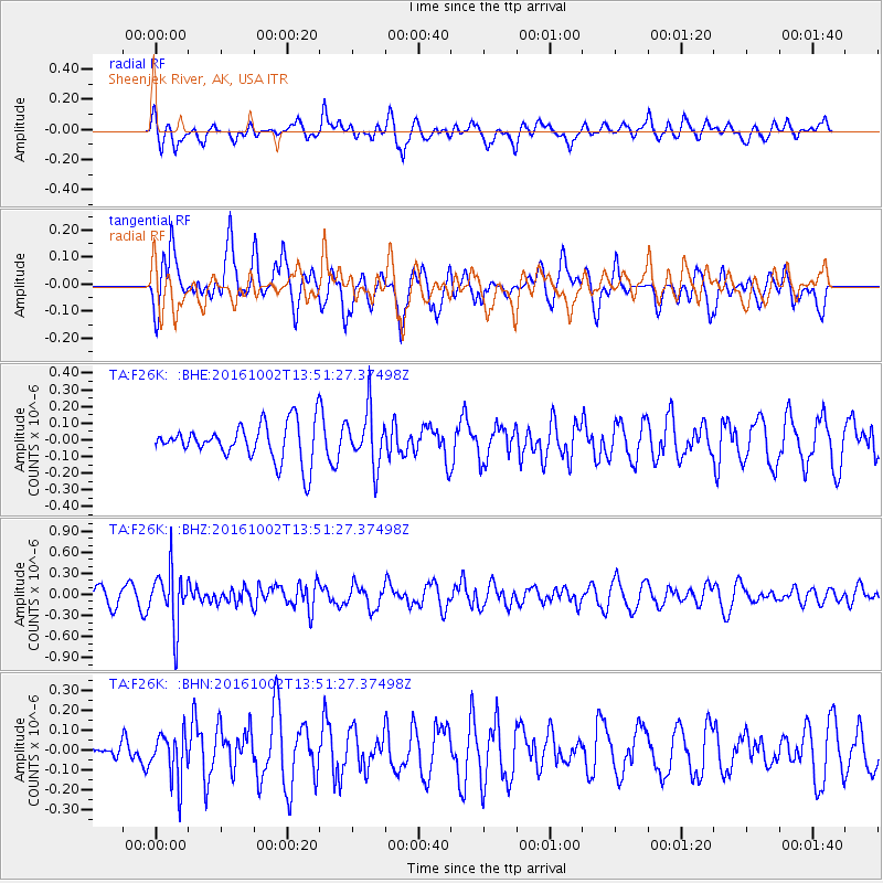
F26K Sheenjek River, AK, USA - Earthquake Result Viewer
*The percent match for this event was below the threshold and hence no stack was calculated.
| Earthquake location: |
Luzon, Philippines |
| Earthquake latitude/longitude: |
16.4/119.8 |
| Earthquake time(UTC): |
2016/10/02 (276) 13:40:04 GMT |
| Earthquake Depth: |
10 km |
| Earthquake Magnitude: |
5.7 MB |
| Earthquake Catalog/Contributor: |
NEIC PDE/NEIC COMCAT |
|
| Network: |
TA USArray Transportable Network (new EarthScope stations) |
| Station: |
F26K Sheenjek River, AK, USA |
| Lat/Lon: |
67.69 N/144.15 W |
| Elevation: |
683 m |
|
| Distance: |
77.3 deg |
| Az: |
22.901 deg |
| Baz: |
281.911 deg |
| Ray Param: |
$rayparam |
*The percent match for this event was below the threshold and hence was not used in the summary stack. |
|
| Radial Match: |
57.198936 % |
| Radial Bump: |
400 |
| Transverse Match: |
68.31493 % |
| Transverse Bump: |
400 |
| SOD ConfigId: |
11737051 |
| Insert Time: |
2019-04-25 16:30:27.796 +0000 |
| GWidth: |
2.5 |
| Max Bumps: |
400 |
| Tol: |
0.001 |
|
Signal To Noise
| Channel | StoN | STA | LTA |
| TA:F26K: :BHZ:20161002T13:51:27.37498Z | 3.0463462 | 4.0404265E-7 | 1.326319E-7 |
| TA:F26K: :BHN:20161002T13:51:27.37498Z | 1.0313114 | 1.187146E-7 | 1.1511034E-7 |
| TA:F26K: :BHE:20161002T13:51:27.37498Z | 1.4435526 | 1.6432213E-7 | 1.1383176E-7 |
| Arrivals |
| Ps | |
| PpPs | |
| PsPs/PpSs | |


