You are here: Home > Network List > US - United States National Seismic Network Stations List
> Station EGMT Eagleton, Montana, USA > Earthquake Result Viewer
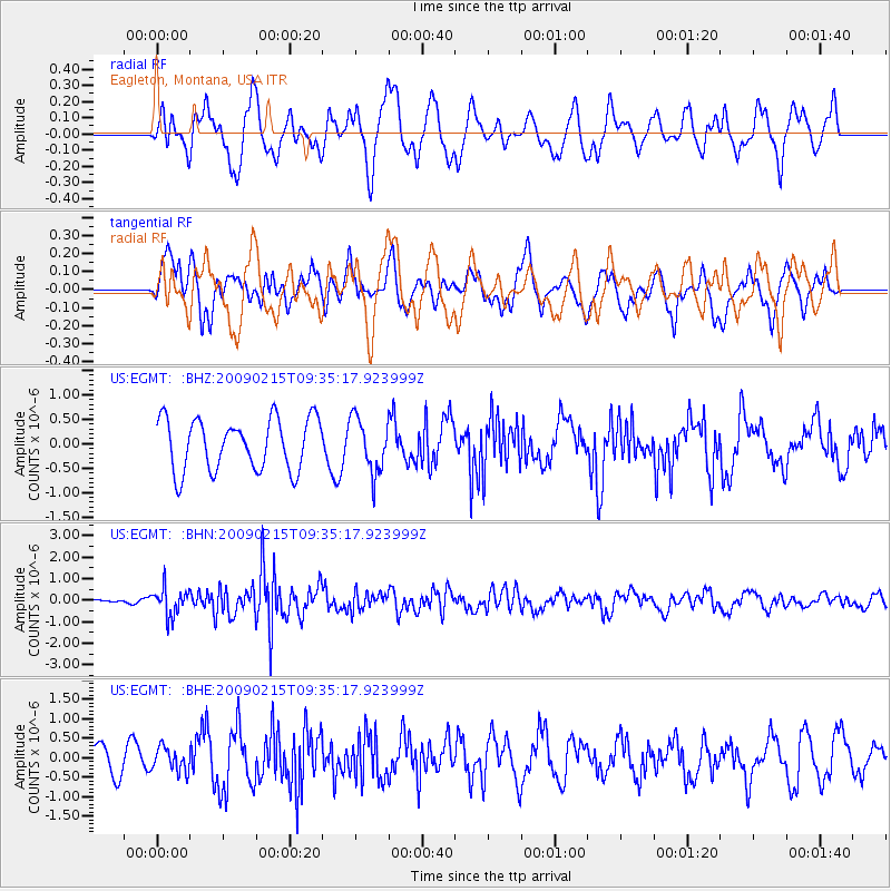
EGMT Eagleton, Montana, USA - Earthquake Result Viewer
*The percent match for this event was below the threshold and hence no stack was calculated.
| Earthquake location: |
Near East Coast Of Honshu, Japan |
| Earthquake latitude/longitude: |
40.2/142.2 |
| Earthquake time(UTC): |
2009/02/15 (046) 09:24:31 GMT |
| Earthquake Depth: |
33 km |
| Earthquake Magnitude: |
6.1 MB, 5.5 MS, 5.7 MW, 5.7 MW |
| Earthquake Catalog/Contributor: |
WHDF/NEIC |
|
| Network: |
US United States National Seismic Network |
| Station: |
EGMT Eagleton, Montana, USA |
| Lat/Lon: |
48.02 N/109.75 W |
| Elevation: |
1055 m |
|
| Distance: |
71.5 deg |
| Az: |
42.328 deg |
| Baz: |
309.838 deg |
| Ray Param: |
$rayparam |
*The percent match for this event was below the threshold and hence was not used in the summary stack. |
|
| Radial Match: |
69.21423 % |
| Radial Bump: |
400 |
| Transverse Match: |
66.18771 % |
| Transverse Bump: |
400 |
| SOD ConfigId: |
2658 |
| Insert Time: |
2010-03-05 07:26:52.012 +0000 |
| GWidth: |
2.5 |
| Max Bumps: |
400 |
| Tol: |
0.001 |
|
Signal To Noise
| Channel | StoN | STA | LTA |
| US:EGMT: :BHN:20090215T09:35:17.923999Z | 2.789928 | 6.399223E-7 | 2.2936875E-7 |
| US:EGMT: :BHE:20090215T09:35:17.923999Z | 0.84283507 | 3.0647556E-7 | 3.636246E-7 |
| US:EGMT: :BHZ:20090215T09:35:17.923999Z | 1.0558091 | 5.5369753E-7 | 5.2442954E-7 |
| Arrivals |
| Ps | |
| PpPs | |
| PsPs/PpSs | |


