You are here: Home > Network List > US - United States National Seismic Network Stations List
> Station EGMT Eagleton, Montana, USA > Earthquake Result Viewer
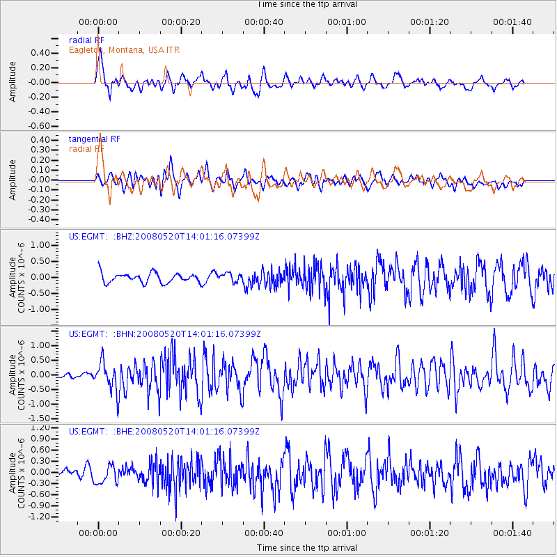
EGMT Eagleton, Montana, USA - Earthquake Result Viewer
*The percent match for this event was below the threshold and hence no stack was calculated.
| Earthquake location: |
Rat Islands, Aleutian Islands |
| Earthquake latitude/longitude: |
51.2/178.8 |
| Earthquake time(UTC): |
2008/05/20 (141) 13:53:35 GMT |
| Earthquake Depth: |
27 km |
| Earthquake Magnitude: |
5.8 MB, 6.0 MS, 6.3 MW, 6.3 MW |
| Earthquake Catalog/Contributor: |
WHDF/NEIC |
|
| Network: |
US United States National Seismic Network |
| Station: |
EGMT Eagleton, Montana, USA |
| Lat/Lon: |
48.02 N/109.75 W |
| Elevation: |
1055 m |
|
| Distance: |
44.8 deg |
| Az: |
64.684 deg |
| Baz: |
302.014 deg |
| Ray Param: |
$rayparam |
*The percent match for this event was below the threshold and hence was not used in the summary stack. |
|
| Radial Match: |
73.867516 % |
| Radial Bump: |
400 |
| Transverse Match: |
58.05064 % |
| Transverse Bump: |
400 |
| SOD ConfigId: |
2504 |
| Insert Time: |
2010-03-05 07:27:04.887 +0000 |
| GWidth: |
2.5 |
| Max Bumps: |
400 |
| Tol: |
0.001 |
|
Signal To Noise
| Channel | StoN | STA | LTA |
| US:EGMT: :BHN:20080520T14:01:16.07399Z | 8.364914 | 5.11259E-7 | 6.111945E-8 |
| US:EGMT: :BHE:20080520T14:01:16.07399Z | 2.1872234 | 2.3296829E-7 | 1.06513255E-7 |
| US:EGMT: :BHZ:20080520T14:01:16.07399Z | 0.86522394 | 1.3063195E-7 | 1.5098051E-7 |
| Arrivals |
| Ps | |
| PpPs | |
| PsPs/PpSs | |


