You are here: Home > Network List > US - United States National Seismic Network Stations List
> Station EGMT Eagleton, Montana, USA > Earthquake Result Viewer
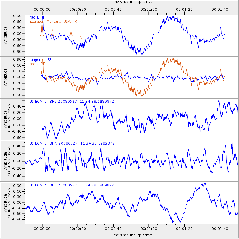
EGMT Eagleton, Montana, USA - Earthquake Result Viewer
*The percent match for this event was below the threshold and hence no stack was calculated.
| Earthquake location: |
Near Coast Of Guatemala |
| Earthquake latitude/longitude: |
13.6/-91.0 |
| Earthquake time(UTC): |
2008/05/27 (148) 11:27:55 GMT |
| Earthquake Depth: |
26 km |
| Earthquake Magnitude: |
5.7 MW, 5.1 MS, 5.3 MB, 5.6 MW |
| Earthquake Catalog/Contributor: |
WHDF/NEIC |
|
| Network: |
US United States National Seismic Network |
| Station: |
EGMT Eagleton, Montana, USA |
| Lat/Lon: |
48.02 N/109.75 W |
| Elevation: |
1055 m |
|
| Distance: |
37.7 deg |
| Az: |
339.343 deg |
| Baz: |
149.275 deg |
| Ray Param: |
$rayparam |
*The percent match for this event was below the threshold and hence was not used in the summary stack. |
|
| Radial Match: |
49.427303 % |
| Radial Bump: |
400 |
| Transverse Match: |
46.760166 % |
| Transverse Bump: |
400 |
| SOD ConfigId: |
2504 |
| Insert Time: |
2010-03-05 07:27:06.335 +0000 |
| GWidth: |
2.5 |
| Max Bumps: |
400 |
| Tol: |
0.001 |
|
Signal To Noise
| Channel | StoN | STA | LTA |
| US:EGMT: :BHN:20080527T11:34:38.198987Z | 2.7145464 | 1.815568E-7 | 6.6882926E-8 |
| US:EGMT: :BHE:20080527T11:34:38.198987Z | 1.6286793 | 5.49259E-7 | 3.3724197E-7 |
| US:EGMT: :BHZ:20080527T11:34:38.198987Z | 1.5415592 | 4.3241184E-7 | 2.805029E-7 |
| Arrivals |
| Ps | |
| PpPs | |
| PsPs/PpSs | |


