You are here: Home > Network List > US - United States National Seismic Network Stations List
> Station EGMT Eagleton, Montana, USA > Earthquake Result Viewer
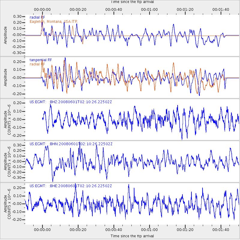
EGMT Eagleton, Montana, USA - Earthquake Result Viewer
*The percent match for this event was below the threshold and hence no stack was calculated.
| Earthquake location: |
Philippine Islands Region |
| Earthquake latitude/longitude: |
20.1/121.4 |
| Earthquake time(UTC): |
2008/06/01 (153) 01:57:24 GMT |
| Earthquake Depth: |
35 km |
| Earthquake Magnitude: |
6.0 MB, 6.2 MS, 6.3 MW, 6.2 MW |
| Earthquake Catalog/Contributor: |
WHDF/NEIC |
|
| Network: |
US United States National Seismic Network |
| Station: |
EGMT Eagleton, Montana, USA |
| Lat/Lon: |
48.02 N/109.75 W |
| Elevation: |
1055 m |
|
| Distance: |
98.2 deg |
| Az: |
31.87 deg |
| Baz: |
312.347 deg |
| Ray Param: |
$rayparam |
*The percent match for this event was below the threshold and hence was not used in the summary stack. |
|
| Radial Match: |
61.294632 % |
| Radial Bump: |
400 |
| Transverse Match: |
60.73559 % |
| Transverse Bump: |
400 |
| SOD ConfigId: |
2504 |
| Insert Time: |
2010-03-05 07:27:09.177 +0000 |
| GWidth: |
2.5 |
| Max Bumps: |
400 |
| Tol: |
0.001 |
|
Signal To Noise
| Channel | StoN | STA | LTA |
| US:EGMT: :BHN:20080601T02:10:26.22502Z | 2.7863932 | 1.7038481E-7 | 6.1148874E-8 |
| US:EGMT: :BHE:20080601T02:10:26.22502Z | 0.95080185 | 4.9509158E-8 | 5.2070952E-8 |
| US:EGMT: :BHZ:20080601T02:10:26.22502Z | 0.901094 | 5.982917E-8 | 6.639614E-8 |
| Arrivals |
| Ps | |
| PpPs | |
| PsPs/PpSs | |


