You are here: Home > Network List > US - United States National Seismic Network Stations List
> Station EGMT Eagleton, Montana, USA > Earthquake Result Viewer
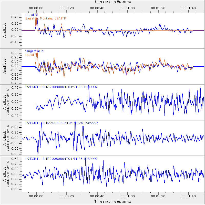
EGMT Eagleton, Montana, USA - Earthquake Result Viewer
*The percent match for this event was below the threshold and hence no stack was calculated.
| Earthquake location: |
Kuril Islands |
| Earthquake latitude/longitude: |
49.9/156.4 |
| Earthquake time(UTC): |
2008/08/04 (217) 04:42:14 GMT |
| Earthquake Depth: |
77 km |
| Earthquake Magnitude: |
5.6 MB, 5.8 MW, 5.7 MW |
| Earthquake Catalog/Contributor: |
WHDF/NEIC |
|
| Network: |
US United States National Seismic Network |
| Station: |
EGMT Eagleton, Montana, USA |
| Lat/Lon: |
48.02 N/109.75 W |
| Elevation: |
1055 m |
|
| Distance: |
57.6 deg |
| Az: |
52.483 deg |
| Baz: |
310.111 deg |
| Ray Param: |
$rayparam |
*The percent match for this event was below the threshold and hence was not used in the summary stack. |
|
| Radial Match: |
62.60705 % |
| Radial Bump: |
400 |
| Transverse Match: |
60.054405 % |
| Transverse Bump: |
400 |
| SOD ConfigId: |
2504 |
| Insert Time: |
2010-03-05 07:27:19.343 +0000 |
| GWidth: |
2.5 |
| Max Bumps: |
400 |
| Tol: |
0.001 |
|
Signal To Noise
| Channel | StoN | STA | LTA |
| US:EGMT: :BHN:20080804T04:51:26.198999Z | 7.1364512 | 4.1234586E-7 | 5.7780237E-8 |
| US:EGMT: :BHE:20080804T04:51:26.198999Z | 1.5772065 | 1.5991378E-7 | 1.0139051E-7 |
| US:EGMT: :BHZ:20080804T04:51:26.198999Z | 1.6881686 | 1.8454936E-7 | 1.0931927E-7 |
| Arrivals |
| Ps | |
| PpPs | |
| PsPs/PpSs | |


