You are here: Home > Network List > US - United States National Seismic Network Stations List
> Station EGMT Eagleton, Montana, USA > Earthquake Result Viewer
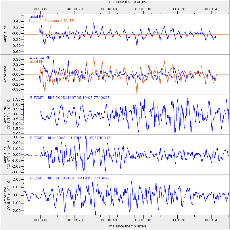
EGMT Eagleton, Montana, USA - Earthquake Result Viewer
*The percent match for this event was below the threshold and hence no stack was calculated.
| Earthquake location: |
Panama-Costa Rica Border Region |
| Earthquake latitude/longitude: |
8.3/-83.0 |
| Earthquake time(UTC): |
2008/11/19 (324) 06:11:20 GMT |
| Earthquake Depth: |
32 km |
| Earthquake Magnitude: |
5.9 MB, 5.9 MS, 6.2 MW, 6.1 MW |
| Earthquake Catalog/Contributor: |
WHDF/NEIC |
|
| Network: |
US United States National Seismic Network |
| Station: |
EGMT Eagleton, Montana, USA |
| Lat/Lon: |
48.02 N/109.75 W |
| Elevation: |
1055 m |
|
| Distance: |
45.7 deg |
| Az: |
334.972 deg |
| Baz: |
141.41 deg |
| Ray Param: |
$rayparam |
*The percent match for this event was below the threshold and hence was not used in the summary stack. |
|
| Radial Match: |
66.31312 % |
| Radial Bump: |
400 |
| Transverse Match: |
70.89278 % |
| Transverse Bump: |
400 |
| SOD ConfigId: |
2658 |
| Insert Time: |
2010-03-05 07:27:27.119 +0000 |
| GWidth: |
2.5 |
| Max Bumps: |
400 |
| Tol: |
0.001 |
|
Signal To Noise
| Channel | StoN | STA | LTA |
| US:EGMT: :BHN:20081119T06:19:07.774009Z | 2.3104267 | 5.427062E-7 | 2.3489434E-7 |
| US:EGMT: :BHE:20081119T06:19:07.774009Z | 0.91358715 | 4.7554306E-7 | 5.205229E-7 |
| US:EGMT: :BHZ:20081119T06:19:07.774009Z | 0.3762689 | 2.2569006E-7 | 5.9981056E-7 |
| Arrivals |
| Ps | |
| PpPs | |
| PsPs/PpSs | |


