You are here: Home > Network List > US - United States National Seismic Network Stations List
> Station EGMT Eagleton, Montana, USA > Earthquake Result Viewer
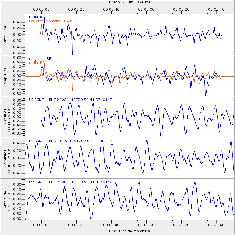
EGMT Eagleton, Montana, USA - Earthquake Result Viewer
*The percent match for this event was below the threshold and hence no stack was calculated.
| Earthquake location: |
South Of Fiji Islands |
| Earthquake latitude/longitude: |
-22.2/-179.7 |
| Earthquake time(UTC): |
2008/11/19 (324) 20:38:58 GMT |
| Earthquake Depth: |
596 km |
| Earthquake Magnitude: |
5.8 MW, 5.2 MB, 5.8 MW |
| Earthquake Catalog/Contributor: |
WHDF/NEIC |
|
| Network: |
US United States National Seismic Network |
| Station: |
EGMT Eagleton, Montana, USA |
| Lat/Lon: |
48.02 N/109.75 W |
| Elevation: |
1055 m |
|
| Distance: |
93.7 deg |
| Az: |
39.197 deg |
| Baz: |
240.772 deg |
| Ray Param: |
$rayparam |
*The percent match for this event was below the threshold and hence was not used in the summary stack. |
|
| Radial Match: |
58.568726 % |
| Radial Bump: |
377 |
| Transverse Match: |
51.54097 % |
| Transverse Bump: |
400 |
| SOD ConfigId: |
2658 |
| Insert Time: |
2010-03-05 07:27:28.075 +0000 |
| GWidth: |
2.5 |
| Max Bumps: |
400 |
| Tol: |
0.001 |
|
Signal To Noise
| Channel | StoN | STA | LTA |
| US:EGMT: :BHN:20081119T20:50:41.374014Z | 2.0595381 | 2.744579E-7 | 1.3326186E-7 |
| US:EGMT: :BHE:20081119T20:50:41.374014Z | 0.60359854 | 2.2482247E-7 | 3.7247017E-7 |
| US:EGMT: :BHZ:20081119T20:50:41.374014Z | 1.2839552 | 5.021684E-7 | 3.9111052E-7 |
| Arrivals |
| Ps | |
| PpPs | |
| PsPs/PpSs | |


