You are here: Home > Network List > TA - USArray Transportable Network (new EarthScope stations) Stations List
> Station G21K Allakaket, AK, USA > Earthquake Result Viewer
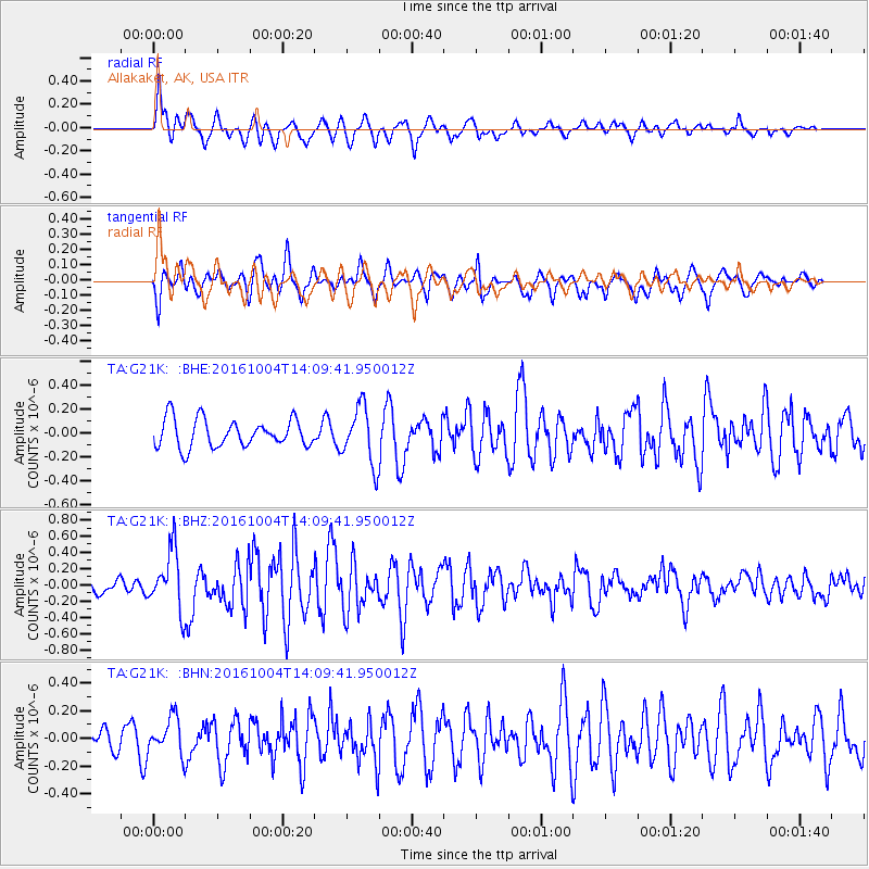
G21K Allakaket, AK, USA - Earthquake Result Viewer
*The percent match for this event was below the threshold and hence no stack was calculated.
| Earthquake location: |
Bonin Islands, Japan Region |
| Earthquake latitude/longitude: |
27.9/142.0 |
| Earthquake time(UTC): |
2016/10/04 (278) 14:00:46 GMT |
| Earthquake Depth: |
30 km |
| Earthquake Magnitude: |
5.6 MO |
| Earthquake Catalog/Contributor: |
NEIC PDE/NEIC ALERT |
|
| Network: |
TA USArray Transportable Network (new EarthScope stations) |
| Station: |
G21K Allakaket, AK, USA |
| Lat/Lon: |
66.52 N/153.51 W |
| Elevation: |
446 m |
|
| Distance: |
54.6 deg |
| Az: |
26.34 deg |
| Baz: |
258.527 deg |
| Ray Param: |
$rayparam |
*The percent match for this event was below the threshold and hence was not used in the summary stack. |
|
| Radial Match: |
70.99012 % |
| Radial Bump: |
400 |
| Transverse Match: |
80.17867 % |
| Transverse Bump: |
400 |
| SOD ConfigId: |
11737051 |
| Insert Time: |
2019-04-25 16:40:49.628 +0000 |
| GWidth: |
2.5 |
| Max Bumps: |
400 |
| Tol: |
0.001 |
|
Signal To Noise
| Channel | StoN | STA | LTA |
| TA:G21K: :BHZ:20161004T14:09:41.950012Z | 3.2214289 | 3.7257843E-7 | 1.1565626E-7 |
| TA:G21K: :BHN:20161004T14:09:41.950012Z | 1.5020345 | 1.3599428E-7 | 9.0540055E-8 |
| TA:G21K: :BHE:20161004T14:09:41.950012Z | 1.6565455 | 1.976689E-7 | 1.1932597E-7 |
| Arrivals |
| Ps | |
| PpPs | |
| PsPs/PpSs | |


