You are here: Home > Network List > TA - USArray Transportable Network (new EarthScope stations) Stations List
> Station O18K Koktuh Hills, AK, USA > Earthquake Result Viewer
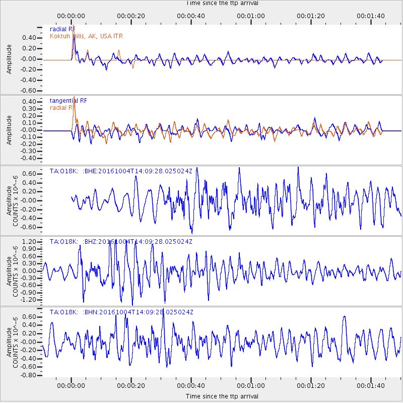
O18K Koktuh Hills, AK, USA - Earthquake Result Viewer
*The percent match for this event was below the threshold and hence no stack was calculated.
| Earthquake location: |
Bonin Islands, Japan Region |
| Earthquake latitude/longitude: |
27.9/142.0 |
| Earthquake time(UTC): |
2016/10/04 (278) 14:00:46 GMT |
| Earthquake Depth: |
30 km |
| Earthquake Magnitude: |
5.6 MO |
| Earthquake Catalog/Contributor: |
NEIC PDE/NEIC ALERT |
|
| Network: |
TA USArray Transportable Network (new EarthScope stations) |
| Station: |
O18K Koktuh Hills, AK, USA |
| Lat/Lon: |
59.85 N/155.21 W |
| Elevation: |
544 m |
|
| Distance: |
52.7 deg |
| Az: |
34.355 deg |
| Baz: |
261.761 deg |
| Ray Param: |
$rayparam |
*The percent match for this event was below the threshold and hence was not used in the summary stack. |
|
| Radial Match: |
61.82415 % |
| Radial Bump: |
400 |
| Transverse Match: |
61.996716 % |
| Transverse Bump: |
378 |
| SOD ConfigId: |
11737051 |
| Insert Time: |
2019-04-25 16:41:24.010 +0000 |
| GWidth: |
2.5 |
| Max Bumps: |
400 |
| Tol: |
0.001 |
|
Signal To Noise
| Channel | StoN | STA | LTA |
| TA:O18K: :BHZ:20161004T14:09:28.025024Z | 3.0490026 | 5.4320014E-7 | 1.7815667E-7 |
| TA:O18K: :BHN:20161004T14:09:28.025024Z | 0.9793774 | 1.643658E-7 | 1.6782683E-7 |
| TA:O18K: :BHE:20161004T14:09:28.025024Z | 1.1831452 | 2.2553544E-7 | 1.9062364E-7 |
| Arrivals |
| Ps | |
| PpPs | |
| PsPs/PpSs | |


