You are here: Home > Network List > TA - USArray Transportable Network (new EarthScope stations) Stations List
> Station R11A Troy Canyon, Currant, NV, USA > Earthquake Result Viewer
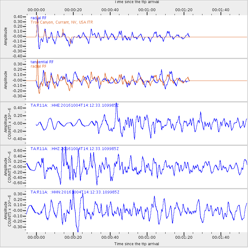
R11A Troy Canyon, Currant, NV, USA - Earthquake Result Viewer
*The percent match for this event was below the threshold and hence no stack was calculated.
| Earthquake location: |
Bonin Islands, Japan Region |
| Earthquake latitude/longitude: |
27.9/142.0 |
| Earthquake time(UTC): |
2016/10/04 (278) 14:00:46 GMT |
| Earthquake Depth: |
30 km |
| Earthquake Magnitude: |
5.6 MO |
| Earthquake Catalog/Contributor: |
NEIC PDE/NEIC ALERT |
|
| Network: |
TA USArray Transportable Network (new EarthScope stations) |
| Station: |
R11A Troy Canyon, Currant, NV, USA |
| Lat/Lon: |
38.35 N/115.59 W |
| Elevation: |
1756 m |
|
| Distance: |
82.1 deg |
| Az: |
50.815 deg |
| Baz: |
299.238 deg |
| Ray Param: |
$rayparam |
*The percent match for this event was below the threshold and hence was not used in the summary stack. |
|
| Radial Match: |
67.280975 % |
| Radial Bump: |
363 |
| Transverse Match: |
68.37212 % |
| Transverse Bump: |
392 |
| SOD ConfigId: |
11737051 |
| Insert Time: |
2019-04-25 16:41:31.560 +0000 |
| GWidth: |
2.5 |
| Max Bumps: |
400 |
| Tol: |
0.001 |
|
Signal To Noise
| Channel | StoN | STA | LTA |
| TA:R11A: :HHZ:20161004T14:12:33.109985Z | 2.4093564 | 2.0802388E-7 | 8.6340016E-8 |
| TA:R11A: :HHN:20161004T14:12:33.109985Z | 0.7491042 | 6.031942E-8 | 8.052207E-8 |
| TA:R11A: :HHE:20161004T14:12:33.109985Z | 1.1444676 | 8.552263E-8 | 7.4727005E-8 |
| Arrivals |
| Ps | |
| PpPs | |
| PsPs/PpSs | |


