You are here: Home > Network List > US - United States National Seismic Network Stations List
> Station EGMT Eagleton, Montana, USA > Earthquake Result Viewer
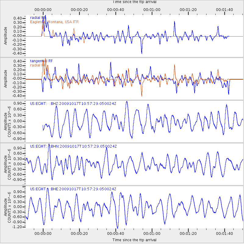
EGMT Eagleton, Montana, USA - Earthquake Result Viewer
*The percent match for this event was below the threshold and hence no stack was calculated.
| Earthquake location: |
Samoa Islands Region |
| Earthquake latitude/longitude: |
-16.4/-172.0 |
| Earthquake time(UTC): |
2009/10/17 (290) 10:45:26 GMT |
| Earthquake Depth: |
10 km |
| Earthquake Magnitude: |
5.7 MB, 5.3 MS, 5.7 MW, 5.7 MW |
| Earthquake Catalog/Contributor: |
WHDF/NEIC |
|
| Network: |
US United States National Seismic Network |
| Station: |
EGMT Eagleton, Montana, USA |
| Lat/Lon: |
48.02 N/109.75 W |
| Elevation: |
1055 m |
|
| Distance: |
84.7 deg |
| Az: |
36.624 deg |
| Baz: |
238.552 deg |
| Ray Param: |
$rayparam |
*The percent match for this event was below the threshold and hence was not used in the summary stack. |
|
| Radial Match: |
56.66864 % |
| Radial Bump: |
400 |
| Transverse Match: |
47.06461 % |
| Transverse Bump: |
400 |
| SOD ConfigId: |
2622 |
| Insert Time: |
2010-03-05 07:27:49.457 +0000 |
| GWidth: |
2.5 |
| Max Bumps: |
400 |
| Tol: |
0.001 |
|
Signal To Noise
| Channel | StoN | STA | LTA |
| US:EGMT: :BHN:20091017T10:57:29.050024Z | 2.0010023 | 5.584492E-7 | 2.7908473E-7 |
| US:EGMT: :BHE:20091017T10:57:29.050024Z | 1.7061875 | 7.259394E-7 | 4.2547458E-7 |
| US:EGMT: :BHZ:20091017T10:57:29.050024Z | 0.81338763 | 3.5842766E-7 | 4.406603E-7 |
| Arrivals |
| Ps | |
| PpPs | |
| PsPs/PpSs | |


